The 50th anniversary of the iconic Clean Water Act (CWA) is the perfect opportunity to celebrate the health and beauty of Maine’s water resources. Our lakes, rivers, streams, and coastline are central to what makes Maine so beloved. There are so many spectacular places to visit, how do you decide where to go? I hope the recommendations here from a few NRCM staff, board, and members will help. Exploring these extraordinary places is a fantastic way to honor those like Senator Ed Muskie whose CWA efforts resulted in the restoration of Maine’s badly polluted rivers. A visit to these special places also reminds us about what’s at stake, and how important it is to stay diligent about protecting our precious water resources, so that future generations will be able to enjoy the same treasured places we love today. —Allison Wells, Senior Director, Communications & Public Affairs
Smalls Falls, Franklin County
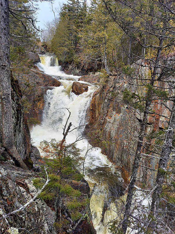
Easily accessible off Route 4 just north of Madrid, Smalls Falls is a wonderful place to experience the awesome power of water. For more than 12,000 years, the Sandy River has been carving its way to the Kennebec, and Smalls Falls provides a record of that journey as it cuts down through bedrock creating a gorge and a series of waterfalls. The falls pulse with the rhythm of the seasons, roaring to life in early spring swollen with snowmelt and spring rains, settling down to a steady, albeit softer flow in the summer months, and surging once again with the fall rains. When I am in this wonderous place, I slow down to geologic time. The fast pace of our human lives gives way to the slow, steady, ongoing natural process that shaped and continues to shape this landscape. There are picnic tables, grills, and an accessible restroom. A few steps from the rest area is the last pool in a series of waterfalls. Crossing a footbridge over the Sandy River leads to a wooded area with towering hemlocks, and while there are no established trails, you can access the upper waterfalls and other areas of the river, with pools for swimming and wading. One should be careful not to equate easy access with lack of wonder. No matter the season, no matter how busy, Smalls Falls is always a reminder of the enduring power of water. It is the pulse of the ecosystem and watershed it drains. I am reminded that if the post-glacial period was to be turned into a two-hour movie, non-native humans would enter the picture in the last three minutes. I am left wondering what this landscape will look like in another 12,000 years. Such is the power of this place. —Marc Edwards, Regional Outreach Coordinator
Reid State Park
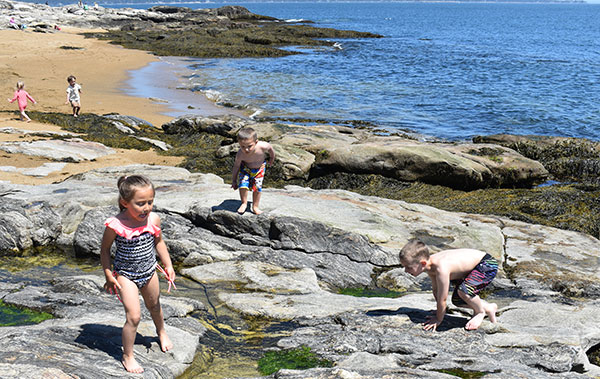
One of my favorite ways to spend a Saturday is getting together with my grandchildren, whether it’s hiking, swimming, or just enjoying being together outdoors. Each Saturday we set out on a new adventure to a place we haven’t been before, or to one we haven’t visited in a while. Early May brought us to Reid State Park, located in the town of Georgetown. May in Maine is normally a little cool for swimming, but that didn’t stop my grandchildren from dipping their toes into the cold Atlantic and exploring the rocky shore. After spending time on the East Beach, we went off to explore further. The lagoon was a short walk, where we found the water was much warmer and fun for all. We then continued down Mile Beach, playing leapfrog with the cold crashing waves. The third beach is called Half-Mile Beach, but by then the troops were beginning to tire from the day of fun and sun. It was time to pack up and head home. The day was an exploration of the beaches; next time we will return to walk the Little River Trail, and of course enjoy the beach and lagoon again.—Kathy Hyttel, Senior Director, Finance & Administration
Sebago Lake
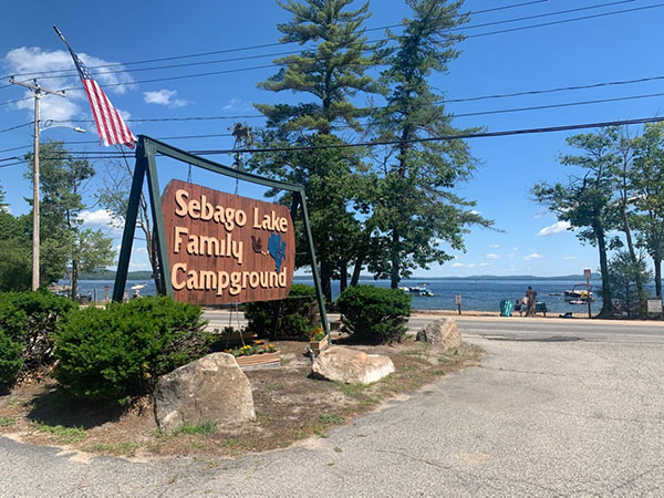
 Derived from the Abenaki term “sobagoo” meaning “resembles the sea,” Sebago Lake is 45 square miles of clear water, the deepest lake in New England, and the second largest lake in Maine. Sebago is not only a recreational resource, but a drinking water supply for one out of every six residents in Maine, and the water source of choice for numerous Maine breweries. Thanks to its heavily forested, 440-square-mile watershed, natural filtration makes Sebago one of a select few lakes in the United States so clean that it requires no filtering. There are numerous access points for tourists and boaters, but I recommend visiting Sebago Lake State Park in Casco, one of the most popular, and for good reason. Last year, I was able to slip in on Maine Resident’s Day (June 19), when access to State Parks is free. But if you can get in after summer crowds, so much the better. Whether it’s the highly affordable night camp sites, lovely tree cover so near to long stretches of sandy beach, or the walking paths noted for beaver activity that run along the Songo River (sometimes called the Crooked River, as it looks like a crazy straw from overhead), Sebago is widely celebrated as one the most beautiful, accessible, and pristine natural resources in Maine. —Abben Maguire, Accounts Payable Coordinator and Administrative Assistant
Pemaquid Point
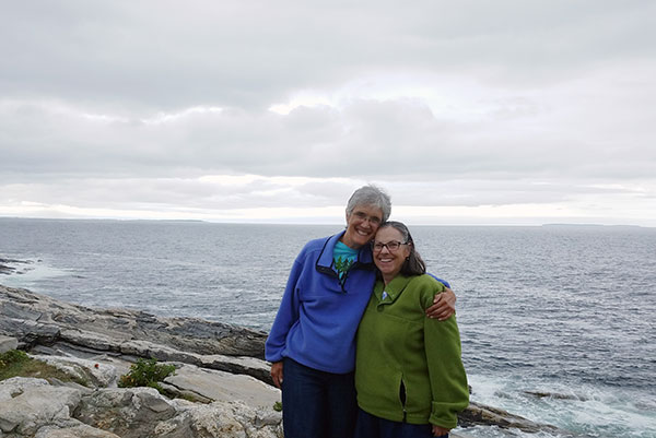
My wife, Kathy, and I regularly go to Pemaquid Lighthouse to relax in the spring, summer, and fall. We carry our portable chairs, cooler with drinks, and stop at Riley’s in New Harbor to get the newspaper to read. Sometimes there are weddings that we observe from afar, but mostly there are just folks there to enjoy the iconic lighthouse, the rocks, and the crash of the surf—a reminder that Maine’s inland waters eventually lead to the sea and why it’s so important to protect our water resources wherever they are. To me, it’s also a perfect place and time of year to say thank you to Senator Muskie for protecting our waters! —Lisa Pohlmann, CEO
Boothbay Harbor
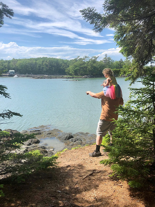
Growing up in Portland, I was fortunate to have easy access to Maine’s beautiful beaches and rocky coastline. Within a 30-minute drive, I had my pick of dozens of beaches, coastal trails, and parks with tide pools to explore, marine wildlife to watch, and ocean sunsets to enjoy. Now that I live in Winslow, I’ve got to travel a bit farther for those experiences. As a dad to a curious
and adventurous three-and-a-half-year-old, I want to ensure she has the same formative experiences on Maine’s coast that I enjoyed in my youth. That’s why each summer I make a point to take Stella to Boothbay, one of my favorite spots in Midcoast Maine. We especially enjoy exploring the Coastal Maine Botanical Gardens and the pathways through the woods and along the shore on the property. Seeing the pure joy on her face when she spots a crab walking across the beach, squawking gulls flying overhead, or a jellyfish washed up on the beach reminds me how lucky we are to live near the ocean in Maine. I’m looking forward to our trip to Boothbay again this summer and for many years to come. —Todd Martin, NRCM Rising Director and Grassroots Outreach Coordinator
Androscoggin River
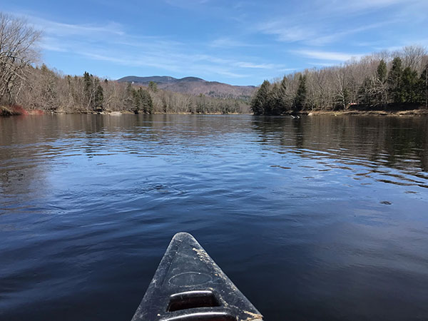
The Androscoggin inspired Senator Muskie to craft the Clean Water Act but, after 50 years, how is it doing? With childhood memories from Rumford in the 1960s of the stinky, toxic river, I joined, with some trepidation, a 2017 NRCM paddle from Gilead to Bethel. It had not been just the paper mill effluent: the river was a dumping site for left-over farm chemicals (including DDT), old tires, gasoline containers, and anything else that was inconvenient (or illegal) to take to the dump. Returning to Bethel after decades abroad, I decided to see if I could be convinced that the Androscoggin wasn’t toxic. Probing questions to Lisa Pohlmann about dioxin residue, fish health, and water quality convinced me I needn’t cringe every time an errant drop of river water touched my skin, and the festive late-summer paddle was a joy. The river is swimmable! (Nasty stuff in the sediment, though, means it will never return to pristine.)
Almost five years later, with the trout flowers blooming and the fiddleheads emerging, we set off for a leisurely early May paddle from Bethel toward Rumford. Having collected two bags of trash and bottles from the road beside the river the previous day, I was not optimistic about the state of the riverbanks, but my concerns were unfounded. In the 10 miles of river, there were only a few items the original Abenaki residents would not have recognized: one plastic bottle and two pieces of paper caught in recent flood debris. This part of the Androscoggin hosts an intriguing collection of four or five long-rusted vintage cars along the water, buried in silt and with mature trees growing in and through them. One wreck near my house has a wooden frame, a lasting reminder of the early days of treating the river and ravines as a dump. It was a glorious day: ripply rapids, glistening sun, a juvenile Bald Eagle, a Belted Kingfisher, and more than 60 Canada Geese floating near my house. River recovery is possible! —Lucy Abbott, NRCM board member, Bethel
Water, the Great Equalizer (Damariscove Island)
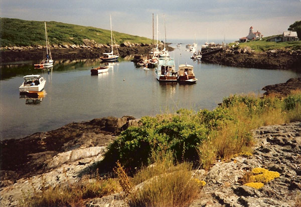
The river doesn’t care how much you paid for your waders or canoe. The ocean doesn’t care whether you are out there for work or pleasure. Danger lurks equally for everyone, while enjoyment is possible for anyone.
I spent my childhood summers sailing the Maine coast. One of my early memories is ending a long day of difficult sailing at Damariscove Island. Located just six miles outside of Boothbay Harbor, Damariscove (now owned by the Boothbay Region Land Trust) has a long history as a working waterfront. The island’s original residents were the Abenaki, and their fishing and farming traditions there continued for centuries even as the populations of people doing those activities changed. On that particular day, we were cruising with another family in their own sailboat, and as we anchored and folded our sails, a fisherman pulled alongside to offer us some of the day’s catch. We were all dressed alike in our yellow foul-weather gear, and all three of our boats were caked in salt splashed onto decks and windows from heavy winds and waves. Despite many differences in our experiences, conversation was easy among us, united by the common language of water.
More recently, a family friend has been teaching me to fly fish. I may have a lifetime of experience reading the wind, waves, and currents of the ocean, but other than swimming in my grandparents’ pond and a few inland kayaking trips, I know little about those particulars as they relate to fresh water. But what I don’t know, he does. We are from different backgrounds and represent different religions, different political affiliations, different genders, and different ages. On the way to the river, we debate dam removal, renewable energy, and Maine’s economy—usually from opposite sides of the issue. However, our shared love of water and respect for nature is more than enough in common to facilitate many fun moments and lasting memories. Water provides a common language for bringing people together over shared interests. —Marlisa Simonson, Senior Director, Philanthropy
Cobbosseecontee Lake
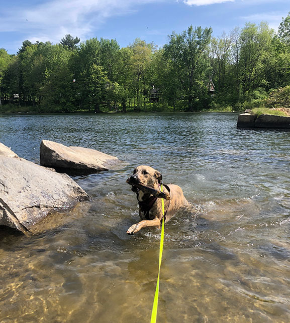
As NRCM celebrates the 50th anniversary of the Clean Water Act, I have been spending a great deal of time thinking about the deep connection that many Mainers have to our watersheds and my own relationship to Maine’s amazing lakes, rivers, and everything in between. Since returning to my childhood stomping grounds last year after buying our home in Gardiner, I have enjoyed revisiting my favorite childhood places and sharing those memories with my friends and growing family. Cobbosseecontee Lake (or Cobbossee, for short) reaches Litchfield, Manchester, Monmouth, West Gardiner, and Winthrop, and is home to many summer camps and camping grounds. It is also home to Maine’s only active lighthouse on inland waters. Like many others in the region, this watershed was an integral part of my childhood. I learned how to doggy-paddle along its shores and caught my first brook trout at the lake’s outlet into Cobbossee Stream. When I got a bit older, I bravely followed my more adventurous friends as they climbed over the railing of the overlooking bridge, counted to 10 once or twice, dove in, and resurfaced shivering from the cold plunge. Now, while I may take a quick dip on a scorching summer day, my new favorite way to spend time on the water is with a good book and the loon song to keep me company. —Vanessa Berry, Sustainable Maine Program Manager
Borestone Mountain Reserve
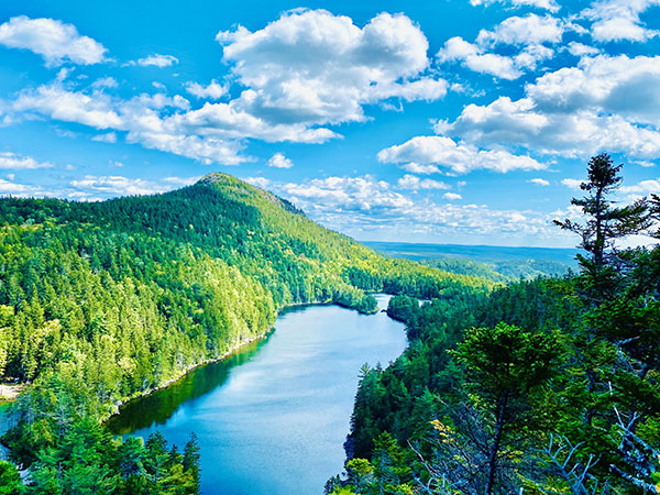
Each year in early September, a group of friends and I spend a long weekend exploring the Borestone Mountain Reserve just outside Monson, in the Moosehead Lake region. Borestone’s remote location with three consecutive ponds, several flat trails, a few uphill hikes, and one challenging bouldering climb provides the opportunity for me to hold onto summer for yet another weekend. My favorite is the Peregrine Trail, which gently winds up a mosscarpeted hillside dotted with colorful mushrooms, to a lookout that takes in the three ponds and Borestone Mountain. It’s a mighty view for little effort. I find it a restful walk that lends itself to reflecting on the seasonal changes that are hinted at all around me. I am always grateful for this one last summer adventure. We paddle the clear ponds, watching the dragonflies laze over the water and listening for a loon’s musical call to its mate. We stroll through yellowing bogs watching for wildlife. And if I’m not feeling my age, I take the two-and-a- half-hour climb up above the tree line, lie down on the warm rocks, and enjoy the 360-degree view of all the glacial ponds and lakes in that region. For me, the area is the essence of the North Maine Woods: a real treasure! Getting to the Borestone Reserve requires parking below the mountain and climbing a mile-long, rocky logging road up to the Nature Center where one signs in, indicating the trails to be walked. —Francesca Galluccio-Steele, NRCM board member, Portland
Lower Narrows Pond
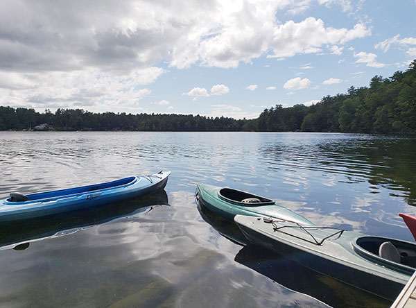
I haven’t met a body of water I didn’t love, but the one that is closest to my heart is Lower Narrows Pond in Winthrop, Maine, about 15 minutes from our office in Augusta. I spent many summers paddling, swimming, and waking up next to this beautiful lake because Camp Mechuwana, the camp I attended as a child and have worked at as an adult, is on this lake. What I love most about Lower Narrows is that, with just one small boat landing to get a canoe, kayak, or small fishing boat onto the lake, there is very little motorized activity, which keeps the water crystal clear. When I am feeling stressed or anxious, I sit on the camp’s boat dock and stare out at the water, looking for loons, eagles, and other wildlife. I miss the mornings of waking up to loons calling across the lake and afternoons spent on our Lodge porch watching a thunderstorm pass over the lake. I learned to paddle a canoe on this lake and spent many weekends chasing wayward canoes across it after they came loose from our boat dock. And, I remember singing songs with camp friends as we spent lazy Saturdays each week splashing around in our waterfront area. Lower Narrows Pond is a place that brings me peace, joy, and a flood of memories from 40+ years of time spent enjoying its beauty. I am thankful for the Clean Water Act and 50 years of protection for all of Maine’s (and the nation’s) waters, but especially this little spot in Central Maine that means so much to me. —Beth Comeau, Communications Manager
Tunk Mountain and Hidden Ponds
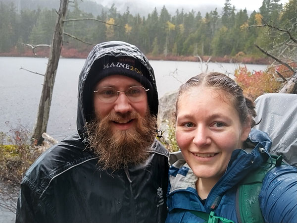
On a rainy day in October, we set out to hike Tunk Mountain and Hidden Ponds, at the northern end of Donnell Pond Public Lands, an ecological reserve nestled between blueberry fields and the coast. As you start the trail, the geologic past and impact of the glaciers are all around you as large boulders are scattered across the landscape. The trail is a moderately difficult out-and-back with the option of a highly recommended side loop to glacially formed ponds, Salmon Pond, Mud Pond, and Little Long Pond. Being a rainy day, we were the only hikers on the trail. As we hiked through the rain, we hoped the ponds would be worth it, and they did not disappoint. As we approached, we were met with sheer rock cliffs, bright red fall colors, and deep clear water, feeling like we were transported to another world, quite forgetting we were on the coast of Downeast Maine. After savoring the magical, fogged-in views of the ponds, we continued up the mountain, over slick and wet rock scrambles, hoping the clouds would clear for a view, which they did not. As we made our way down the mountain at the last possible overlook, the clouds cleared for a few moments to offer amazing views of the ponds, Tunk Lake, and a glimpse of Frenchman Bay. Tunk Mountain and Hidden Ponds are a short drive from Mount Desert Island, and if you find yourself out that way, we highly recommend a visit. —Codi Riley-Havu, Gifts, Records, & Stewardship Coordinator


