This year, the Natural Resources Council of Maine celebrates 60 years of protecting the nature of Maine. We are making time to pause and reflect on what we have accomplished together: clean air, clean water, and an abundance of special places that provide recreational opportunities that many of us love, like hiking, swimming, paddling, and wildlife watching. Such places also offer opportunities to refocus and rejuvenate. In celebration of our 60th, I am sharing with you a few of our collective favorite places in Maine. These have been protected thanks not only to NRCM and many like-minded people we have had the pleasure of working with over the years. We hope you enjoy them as much as we do!—Lisa Pohlmann, CEO
Gardiner Waterfront Park: A River Runs Through It
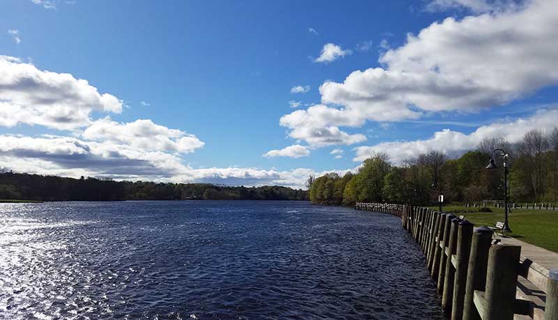
Photo by Levi Hahn
Maine’s incredible bodies of nature’s finest life-sustaining resource induce awe in a newcomer like me. From the sea to the inland rivers and lakes, it’s difficult to choose a particular location in a state that I’ve largely yet to explore. I moved to Maine at the end of December and am continually impressed by the pureness of the waters here. One exceptional site that I’ve come to enjoy is Gardiner’s Waterfront Park. Conserved thanks in part to the Land for Maine’s Future program, the park offers a spectacular vantage of the Kennebec River as it begins one of the last legs of its journey to meet merrily with the Androscoggin and head to the coast. Steps away, the Kennebec River Rail Trail follows the mighty waterway for more than six miles in the other direction to Augusta and the site of the former Edwards Dam, the removal of which has substantially improved conditions for aquatic life. It’s quite remarkable that the river is so clean by the time it reaches Gardiner considering all the territory through which it previously passes. When I send photos to friends and family back in Pennsylvania, they incredulously ask, “Is the water really that blue?” Thanks to NRCM’s 60 years of work, it is. —Levi Hahn, NRCM Social Media Manager
Whitecap Mountain: Views, Wildflowers, and Blueberries
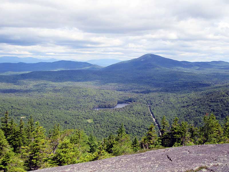
Whitecap Mountain, Rumford. Photo by Linda Woods
Maine hikers are fortunate that the Land for Maine’s Future has protected so many beautiful areas, including much of Maine’s High Peak region. As I age, I am discovering smaller mountains that provide enough of a workout and also prefer loop hikes so as to have varied terrain. A 4.6-mile loop hike described as “moderate” by Maine Trail Finder, Rumford Whitecap (2,214 ft.) is a true gem that meets both of these criteria. Whenever I hike it, I choose the Starr Trail, located 100 yards north of the parking lot, a fairly continuous ascent with several water crossings. The trail passes through part of the state’s largest red pine stand. Part of this trail follows a stream, which provides an invigorating backdrop. Near the summit, the trail changes to ledges with several steep places. he reward here is a view of Maine’s fifth highest peak, Old Speck, as well as its neighboring peaks. During a late-summer hike on this section, my husband and I found several fall flowers: small gerardia, eye bright, nodding ladies’ tresses, spotted coral root, and, our best find, mountain sandwort—an alpine flower. The top provides a 360-degree panoramic view of the Mahoosuc Range and the White Mountains to the West and North, the town of Mexico to the East, and Mt. Zircon and many other summits of the Oxford Hills and Androscoggin River Valley to the South. Since the summit of Rumford Whitecap is as bald as its name implies, the top can be very windy. The few trees there are short and wind-effected, with branches growing primarily on one side. It’s a popular hike, but there is plenty of space on top to spread out and find privacy. As a reward for summiting during blueberry season, the berries seem endless—we easily filled two water bottles during a July trek. To complete the loop hike, I descend on the Red Trail, which feels like an easy walk in the woods. This returns directly to the parking lot. Although I’ve not been to the summit in winter, a friend of mine has, and he easily followed in the heavily traveled snowshoe trail. The easy access from a road and incredible view make Rumford Whitecap a four-season destination. As always, before starting a hike, I advise you to check mainetralfinder.com for trail maps and details. —Linda Woods, NRCM Member, Waterville
Beech Hill Preserve: Perfect Getaway on the Coast of Maine
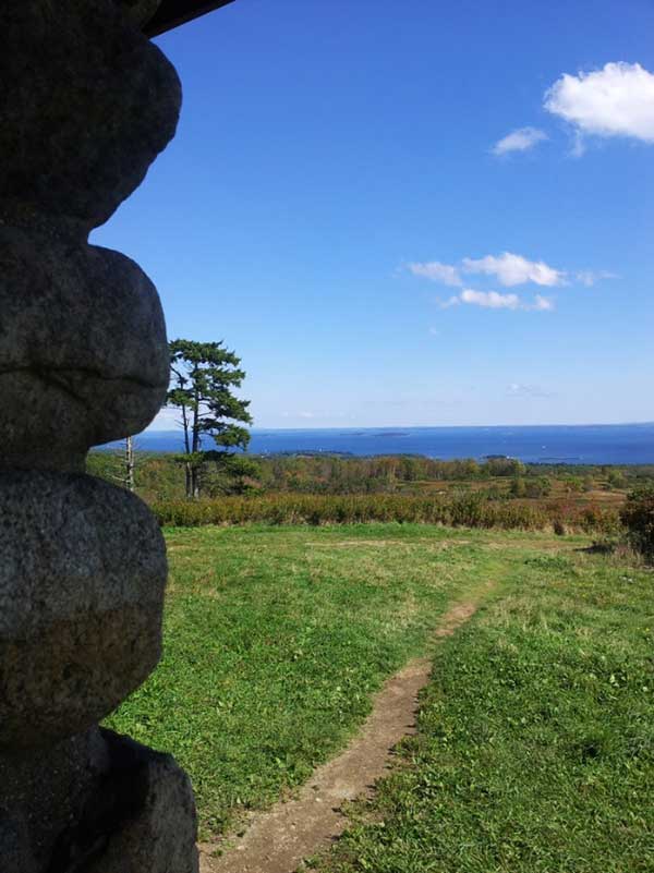
View from Beech Nut. Photo by Gabby Grunkemeyer
This preserve in Rockport was purchased with the support of the Land for Maine’s Future program. Owned and managed by Coastal Mountains Land Trust, it is 295 acres of woodland and blueberry barrens, and it is a perfect half-day getaway on the Maine coast. I like the easy Summit Trail because it is one of those rare finds on the coast that allows you to ascend out in the open, giving you plenty of time to take in the 360-degree views of the Camden Hills and soak up the sun. It’s great for hiking, snowshoeing, and bird-watching. As you climb up the back side of the hill, you slowly wind your way through an actively farmed blueberry field. As the trail crests the hill you get your first wide-open glimpse of Penobscot Bay. On a blue-sky day you can see all the way to Cadillac Mountain at Acadia National Park; if it’s not a clear day, the view of the emerald green waters of the bay are equally as breathtaking. The trail ends at a stone hut known as Beech Nut, built in the early 1900s as a tea house and picnic spot for the local community. There is a lot to take in from this bird’s eye view of the coast so take the time and sit a while if you can.—Gabby Grunkemeyer, NRCM Grants Director
Moosehead Lake Region: What Could Be Better?
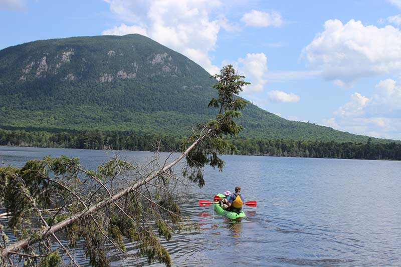
Jason Heindel and his daughter enjoying Moosehead Lake with Little Spencer Mountain in the background. Photo by Dyanna Czeck
There are few wild places left in this country, particularly on the East Coast. We are fortunate to have the Moosehead Lake region. I first visited the area in the mid-1980s when I was a teenager going to the Boy Scout High Adventure base housed at Pittston Farm. Canoeing for a week and hardly seeing people outside our group left a lasting impression. About a decade later, I joined my best friend’s family at Spencer Pond Camps adjacent to Moosehead Lake’s Spencer Bay. Two weeks of relaxing in the shadows of Big and Little Spencer Mountains and Lobster Mountain, and kayaking on a pond… what could be better? And before I knew it, that summer started 20 years of Moosehead region trips, now with my wife and daughter. We can’t take the wild nature of Moosehead for granted. Threat came in 2005 when Plum Creek attempted to develop much of its holdings around Moosehead Lake, proposing hotels, condos, and ski resorts. Thankfully, through the efforts of NRCM and others, the proposed development never happened. My joys of coming to the region now are to share the natural beauty with my five-year-old daughter, to teach her about the outdoors and wildlife. She loves playing in the pond, looking for moose, and hearing a beaver whack his tail on the water. Will the Moosehead region be wild when she has her own children? I am hopeful because I know NRCM will be here to protect it. —Jason Heindel, NRCM Member, Bayside, Wisconsin
Maine’s Fish River Watershed: Natural Relationships
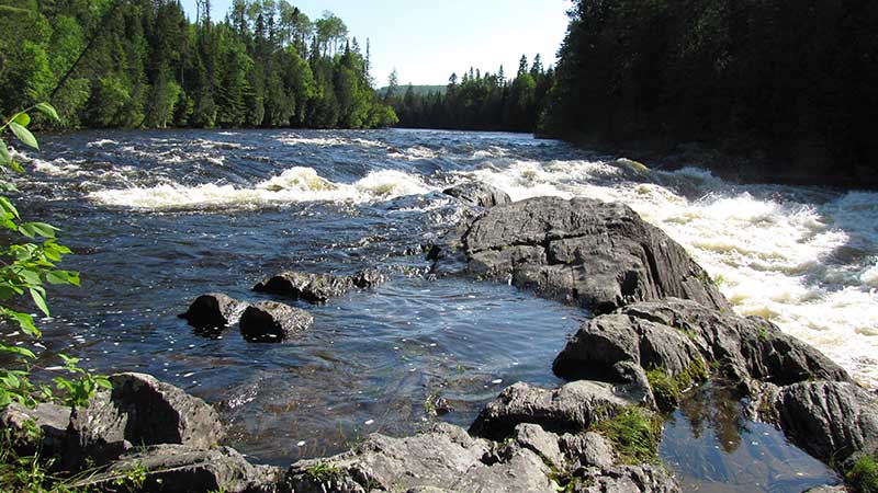
Fish River Falls. Photo by Ann Flewelling
To be in the wildness of woodlands and lakes is to open up to the gifts of solitude and connectedness, awe and adventure, peace and playfulness. Here, people tend to relax and renew, enjoy and explore. Here, healing between self and other can take place, whether the “other” is a human or the natural environment. In 1949 my parents built our family camp on Cross Lake. It was our vacation retreat from working farm family life and home along the Aroostook River, an area settled almost entirely by Protestant English Loyalists. Farther north along the St. John River Valley earlier immigrants had already arrived in the mid-18th century with the Acadian diaspora. The English were sometimes regarded by the French as “blue noses” while the English might regard the Catholic French as somehow inferior. It happened that our Protestant family camp was built next to a former Catholic retreat named Priest Point. Our curiosity peaked. Meanwhile, along our shore there continued to wash up arrow heads, spear points, scrapers— evidence of America’s first peoples inhabiting this very space. We’d been caught up in our larger history. The shared human attraction to the pristine spaces of the Fish River Chain of Lakes and watershed with its sparkling gems and the green deep woods encouraged a healing of the cultural divide, both English and French neighbors sharing the watershed in a spirit of cooperation and respect: inclusiveness immerged this place. Today we find hikes to Fish River and the Falls a family favorite. We encounter an assortment of other hikers on the trail: locals, young, old, University of Maine at Fort Kent students of all ethnicities. In response to the threat of an open-pit mine at Bald Mountain that would have put this spectacular place at risk, NRCM worked with concerned people in the region and elsewhere to help pass the toughest mining law in the country in 2017. It is as though with the confluence of the Falls a bounty of diverse yet common humanity now flows powerfully together. —Ann Flewelling, NRCM Member, Sedgwick
St. John River: A Bond, Not a Boundary
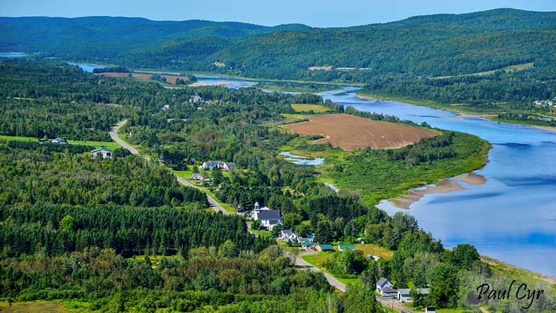
Looking west over the village of St. John. Photo by Paul Cyr
My enchantment with the majesty of the St. John River is renewed every time I travel US Route 1 between Van Buren and St. Francis, which I did at least four times a year when I published Echoes, a quarterly magazine that needed to be delivered to stores in the St. John Valley. The sweeping vistas of the river curving between Maine and New Brunswick excite me in every season, especially when the ice is moving in the spring. My appreciation of the St. John and the communities lining its banks was kindled in the 1970s, when I wrote extensively about a proposal to erect a pair of hydroelectric dams at Dickey and Lincoln School that would have inundated the town of Allagash, forcing its residents to relocate. NRCM helped to defeat the proposal, preserving both the free-flowing river and the town, which, like communities all the way to Fredericton, New Brunswick, derive an identity from their riverside locations. Settlements that spanned the river before the Webster-Ashburton Treaty made it an international border in 1842 continue to celebrate a valley culture where the river is a bond, not a boundary.—Kathryn Olmstead, NRCM Board Member, Caribou
Caribou-Speckled Wilderness: A Place of Solitude and Rejuvenation
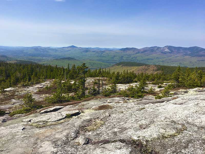
Photo by Ryan Linn
When most people think of the White Mountain National Forest, they may think of New Hampshire and nowhere else. But the edge of the National Forest that pokes into Maine has been one of my preferred places for wilderness and rejuvenation. From Portland, I can get to Brickett Place in less than two hours, and head into the Caribou-Speckled Mountain Wilderness. Head up Speckled Mountain and you might see just a handful of people even on the busiest of days. Standing on the rocky ridges on the hike up to the Wilderness area’s highest point (Speckled tops out just below 3,000 feet), it’s not uncommon to hear nothing but a slight breeze and the chirping of a few song birds. Rising high to the West is the mammoth Mt. Washington with its summit towers and visitor center, but in all other directions you can barely see any sign of humanity among the hills and lakes below.
Wild and natural places like this bring me back to the Maine of my childhood. Growing up in Unity, my backyard and the woods beyond were an infinite playground—a place of wonder and discovery without end. These days, my playgrounds are farther afield and take different shapes. As I wander along trails in the quiet forests and mountains, my mind can drift in other directions, relaxing while my legs do the hard work of getting my body where it’s going. After a while without running into other people or hearing sounds of cars passing by, I can feel the stresses of everyday life evaporating away from me like fog lifting off the bay. I can find solitude like this in the Caribou-Speckled Mountain Wilderness. It’s a treasure that gets harder and harder to find in our busy, crowded world. We’re lucky to have a place like this so close to home. This summer there will probably be thousands of people hiking all over the Presidential Range and Franconia Ridge, but as for me, I’ll be listening to the wind and the birds in the quieter side of the White Mountains. —Ryan Linn, Portland, NRCM Rising Leadership Team Member
Spring in Maine: Water, Water Everywhere!
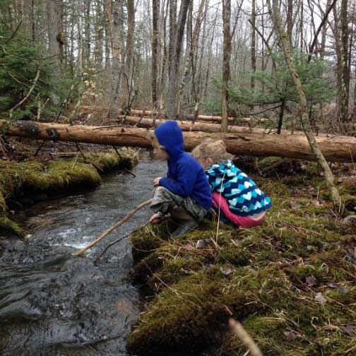
Photo by Leslie Burhoe
I love to take my grandchildren into the woods any time of year, but spring is the favorite! They put up with me dragging them along the trails looking at this, that, and another thing—a mushroom, a salamander hiding under some leaves, green somethings poking through the debris on the forest floor. But the thing that really lights them up is the streams. Grab a stick, throw a rock, watch the leaf go down the rushing water like their grandChris’s boats. We can follow as long as their clothes stay dry and our snacks hold out. I have been an NRCM member for 20 years, and these are some of the reasons why: helping to keep Maine’s water clean, and our forests healthy and accessible for future generations. —Leslie Burhoe, NRCM Executive Assistant
Penobscot River: The Gift that Keeps on Giving
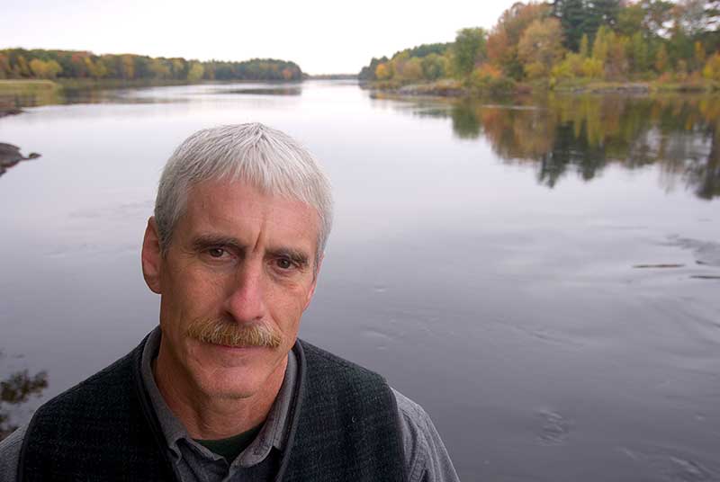
John Banks on Penobscot River. Photo courtesy of John Banks
Home to the Penobscot Nation for 10,000 years, the Penobscot River and its many tributaries is truly a special place to celebrate for lots of reasons. Maine’s largest watershed provides an amazing ecological diversity that supports a host of critters and aquatic life. When I think of the familiar phrase ”Maine, The Way Life Should Be” my thoughts immediately go to the many times I’ve paddled her waters enjoying the sights and sounds of Bald Eagles, Osprey, otters, and ducks, and harvesting the many gifts that she continues to provide. Today, with fewer sources of pollution and main stem dams removed, the river is realizing an unprecedented ecological renaissance that gives me tremendous hope for the future health of this great watershed. Indeed, a great place to celebrate!—John Banks, Natural Resources Director for the Penobscot Nation
Kennebec River, North Anson to Madison: Unequivocally Special
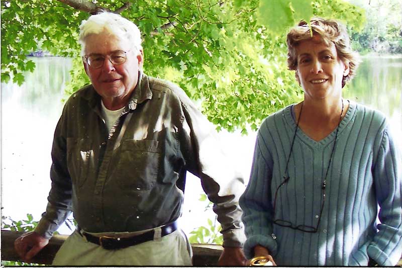
Patty Hager and her dad. Photo courtesy of Patty Hager
Lately, I have been bonding with the six-mile stretch of the Kennebec River from North Anson to Madison. This seldom paddled flat-water trip takes the boater past old log boom pylons and the historic 1817 Weston farmhouse high on the eastern bank. The river winds through islands whose wetlands protect ducks and wading birds, and host many other species including Bald Eagles and brown trout. At the prominent point below Weston Island, the newly conserved Weston Woods and Waters land offers the chance to stop for a woods walk along an esker overlooking an especially pretty bay. Begin in North Anson at the public boat ramp on Madison Road, and take out at the Madison boat ramp on the east shore. I recently came across some of my late father’s correspondence with NRCM from 1991 when both the Dead and Kennebec Rivers were threatened by a proposed mining dump upstream on Alder Pond. Had NRCM not led the way preventing that project, acid and heavy metals released into the waters might have irretrievably damaged both rivers, including this lovely Anson/Madison stretch. In Dad’s words, “Natural resources and the stature of these rivers deserve proven and unequivocal protection.” He was deeply grateful to NRCM, and so are his descendants, for providing that unequivocal protection for our beloved Kennebec.—Patricia Hagar, NRCM Board President
Maine’s North Woods: Katahdin Woods and Waters and More
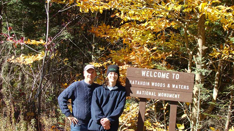
Ernest and his son, Marshall. Photo courtesy Ernest Wright
For its beauty and remoteness, the North Woods area remains our favorite area in Maine. Determined to learn about the North Woods, I found the Natural Resources Council of Maine and was drawn to its mission. I was pleased to learn that protecting Moosehead Lake from a sprawling development proposal was one of NRCM’s priorities. The website also alerted me to a new conservation proposal in the North Woods. For months, I followed the effort on NRCM’s website and even planned a trip to explore the land with my oldest son. Sharing pictures of our trip with NRCM, I was encouraged to offer my experiences in a blog entry. Then a couple years later, after many public hearings and visits from public officials to the area, Katahdin Woods and Waters National Monument was created! That same year, I returned to visit the land with my sons, proud that we had been a small part of something big. Now, with NRCM’s help, I’m keeping tabs on LUPC’s Adjacency Principle. Thank you, NRCM, for allowing us a voice in shaping the future of Maine’s beautiful landscapes and wild places.—Ernest Wright, NRCM Member, North Chesterfield, Virginia
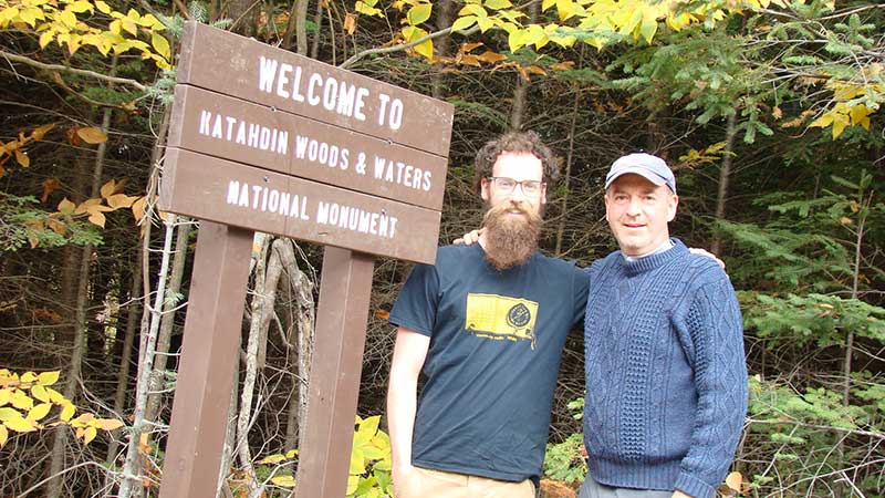
We couldn’t post a pic with one son and not the other! Braden and Ernest Wright at KWW, photo courtesy Ernest Wright
Kennebec River, Sidney to Augusta: A Paddler’s Delight
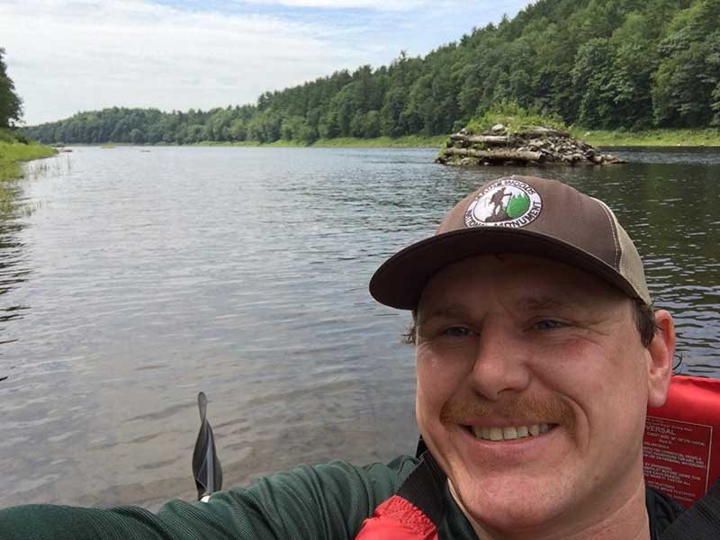
There is no shortage of special places to paddle in Central Maine, but one of my favorite day trips is the Kennebec River between Sidney and Augusta. Put in your canoe or kayak in at the Sidney boat launch, located off West River Road. Time your trip with the outgoing tide, otherwise you’ll be paddling against the current, making your job extra difficult. I’ve paddled this eight-mile stretch many times and have never failed to see Bald Eagles, Great Blue Herons, and jumping sturgeon! Along the way you’ll see remnants of Maine’s bygone log driving days: a series of wooden and earthen pylons that helped prevent logjams. Just before the end of your paddle at Augusta Waterfront Park, you’ll pass the site of the former Edwards Dam, which NRCM helped get removed from the river in 1999 following a 10-year effort. Since the dam’s removal, millions more alewives and other fish have returned to the river, along with Bald Eagles and other birds and animals who feast on them.—Todd Martin, NRCM Rising Director and Grassroots Outreach Coordinator
Bigelow Preserve: Challenging Hikes Worth Every Step
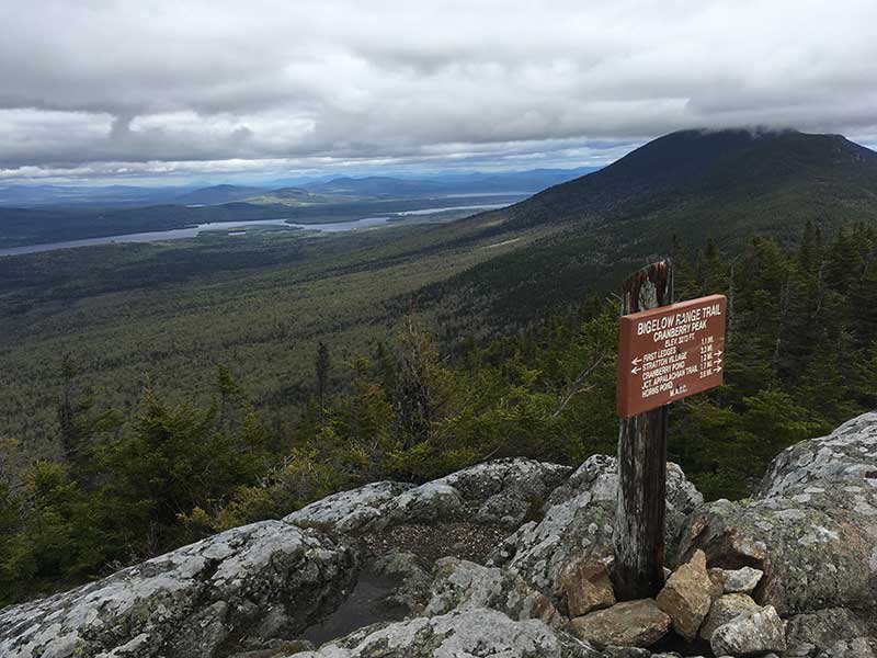
Cranberry Peak, Bigelow Preserve. Photo by Pete Didisheim
The Bigelow Preserve is one of my absolute favorite hiking destinations, and there are so many ways to tackle the range. These are challenging hikes, but every one of them is worth it. Cranberry Peak at the western end provides spectacular views of Flagstaff Lake and beyond. Little Bigelow at the eastern end is a nice day hike. The most accessible route to Avery Peak (4088 feet) is up the Safford Brook Trail. The views from Avery are stunning. For one of Maine’s most demanding and rewarding loop trails, head up the Fire Wardens Trail to ascend Avery Peak, then follow the ridge along the Appalachian Trail, crossing over West Peak (4145 feet) to Horns Pond, then down the Horns Pond Trail to the Fire Wardens Trail. Every time I visit the Bigelows, I am so thankful for the work that NRCM, Friends of Bigelow, and so many others did to protect this 36,000-acre reserve in 1976 through a citizen-initiated referendum. —Pete Didisheim, NRCM Senior Director of Advocacy
Back Cove: Runners’ Delight on a Summer Night
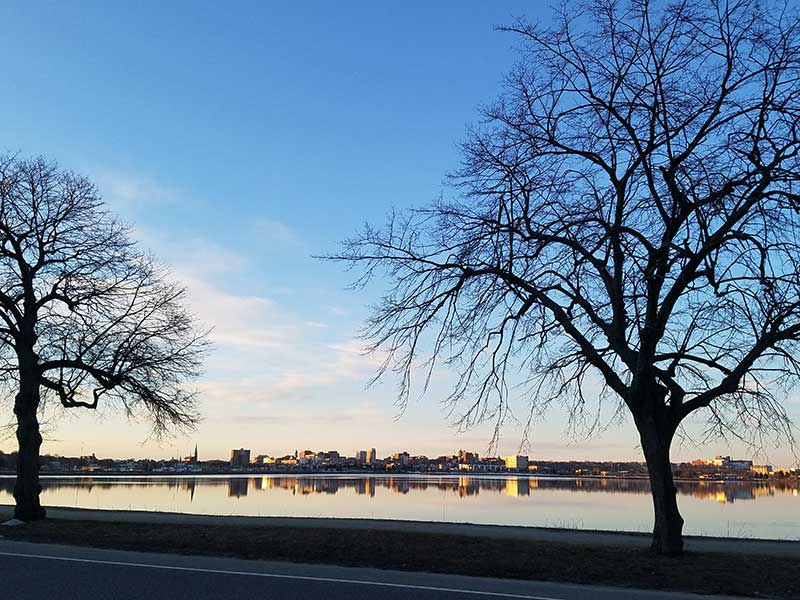
Portland’s Back Cove. Photo by Beth Comeau
Every Wednesday evening during the summer months, just as the heat of the day starts to dissipate and people start to fire up their grills or take the dog for a walk before dinner, several hundred runners gather at Back Cove on Baxter Boulevard in Portland. A fundraiser for the local nonprofit Portland Trails, the Back Cove Race Series is in its 17th year and represents the best of Portland: stewardship, commitment, and value. Portland Trails is committed to protecting the green spaces in and around Portland, and helping connect people to the natural world—the perfect complement to NRCM’s many Back Cove cleanup events and statewide work protecting Maine’s clean air and water. Participants in NRCM’s New Year’s Eve Polar Bear Dip & Dash will find these races much warmer—and there are 14 to choose from! This event has raised more than $45,000 for Portland Trails since the race’s inception in 2003. It’s a great way to celebrate all of the great work that has been done to protect Maine’s environment! —Stephen Chabot, NRCM Member, Portland
Take Me to the River
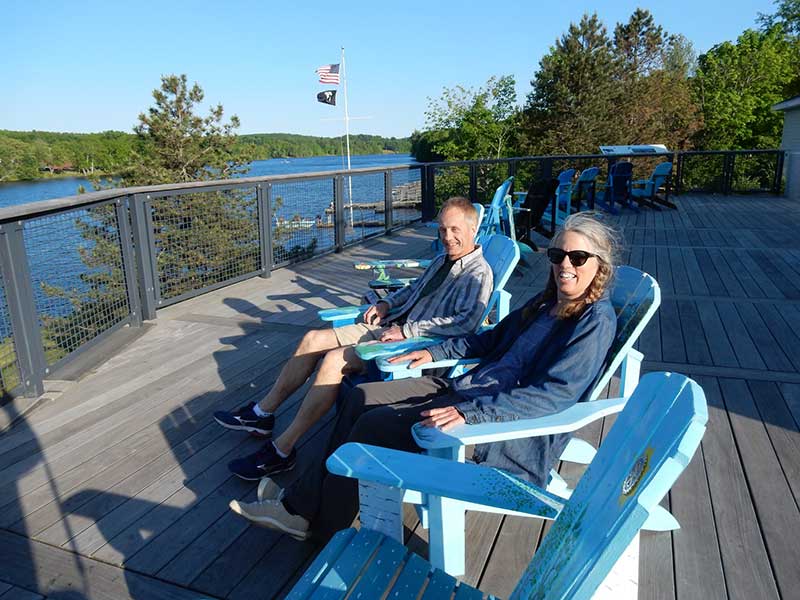
Tina Woods and husband Robert Kus, founders of Upstream
It’s been 20 years since removal of the Edwards Dam in Augusta, and the Kennebec continues to rebound. Relax and enjoy the view of the river from an Alewife Adirondack Chair on the Pumphouse Deck at Gardiner Waterfront Park! Watch Bald Eagles and Osprey hunt for fish. See— and hear—sturgeon leap from the water and land with a giant splash. Marvel at how amazing it is that nature can recover when people who care get involved. The Alewife Adirondack Chairs were painted by Gardiner Area High School students in honor of the river’s wildlife in coordination with Upstream, a local nonprofit working to restore fish passage to the Kennebec’s Cobbosseecontee Stream. “Like” Upstream on Facebook or contact them at upstreamcobbossee@gmail.com, and plan to visit this unique spot celebrating the Kennebec River!
Finding Paradise
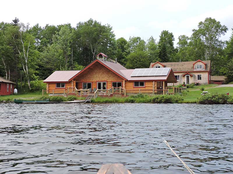
Red River Camps. Photo by Glenn Tikkanen
We have spent much time in the North Maine Woods. The Allagash Wilderness Waterway is full of history. Much of our fishing and exploring was at Pierce Pond, just south of the North Maine Woods boundaries. Much time was spent at remote ponds, some accessible only by hike-in and others, drive-in, as they were within a couple hundred feet. As time passed, such escapes became more of a chore then an exciting pastime! During one visit, I tripped from the canoe, motor in hand, and my wife faced reality. She caught the motor and broke my fall, but these fishing days were over, it seemed—how were we going to fish at least a few more years?
We still wanted solitude and peace. Red River Sporting Camps in T15R9 had many beautiful ponds and lakes, a mountain range to the North with huge rock slides, polar caves, miles of hiking trails, and campsites. The abundance of wildlife is unimaginable: moose, bear, deer, black ducks, mergansers, and the “call of the wild,” the Common Loon. The fishing opportunities were tremendous. We fished a lot and never found a time that didn’t become a lasting experience. Time and health caught up with us, so our three trips to Red River Sporting Camps are beautiful and lasting memories we will cherish the rest of our lives. —Glenn Tikkanen, NRCM Member, Norway, Maine
Originally published in 2019 edition of Explore Maine


