This year marks passage of Maine’s first-ever trails bond! More than 500 organizations, businesses, and communities came together with NRCM urging legislators to pass the measure. Now the Maine Trails Bond will appear on the November ballot. If approved by Maine voters, the bond will provide $30 million over 4 years for the design, development, and maintenance of trails for walking, hiking, biking, snowmobiling, cross-country skiing, wildlife watching, horseback riding, and more. To help you decide which trails you might like to explore this summer, NRCM staff, members, and supporters offer their picks. Enjoy!
—Allison Wells, Senior Director, Communications and Editor
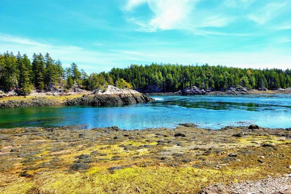
Reversing Falls, by Stephanie Griffin
Reversing Falls, Pembroke, Washington County
Located in the quaint Downeast town of Pembroke, Maine, Reversing Falls is situated between Dennys Bay and Cobscook Bay. Reversing Falls is a wonderful place to visit for families and solo adventurers alike. It is also accessible to a wide range of skill levels and offers amazing views of the tidal falls. If you hike all the way out, you will find a nice little point to take in almost 360° views. Calm and generally quiet, it makes for a great place to unwind, reflect, and enjoy nature.
—Stephanie Griffin, NRCM supporter

Photo courtesy of Senator Rick Bennett (R-Oxford)
Jockey Cap, Fryeburg
Western Maine is blessed with scores of extraordinary trails through some amazing terrain, but one of my favorites—because it is accessible and gives immense value for little time and effort—is Jockey Cap in Fryeburg. A peculiar granitic outcrop in the Saco Valley, this small hill sits by itself among the White Mountain giants, and as such provides the temptations of adventure beyond and a picturesque view of Fryeburg village below. Less than a mile round trip—including exploring the boulder caves along the way—the trail is accessible from Route 302 at Mollyockett Elementary School, Jockey Cap Restaurant, or a small parking area just east of the Dollar General. The winding trail eventually comes to a steep 0.1-mile climb to the summit, which is a wonderful place for a picnic lunch. At the top, a monument to local hero and Arctic explorer Adm. Robert E. Peary consists of a panoramic landscape compass, with every visible summit depicted to scale and aligned for ease of identification. Jockey Cap is the sort of unique attraction that can be enjoyed if you find yourself with an extra 20 minutes when driving through the area. It will get your blood flowing and put a smile on your face.
—Senator Rick Bennett (R-Oxford)
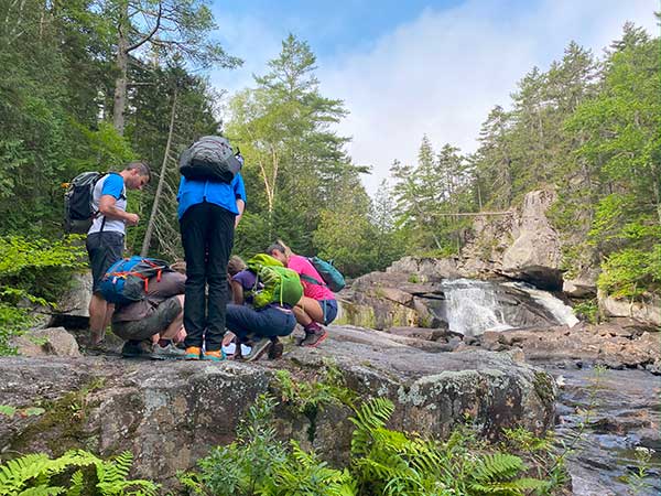
Photo by Mike Smith
Nesuntabundt Mountain and Pollywog Gorge
Maine’s Katahdin region is known for many wonderful destinations, but few bring me as much delight as a trip out the Jo Mary Road, near the region’s southern end. Out here, you can explore several trails and waterways, with adventures ranging from multi-day backpacking trips to casual summer picnics alongside waterfalls and lakeshores. In the heart of it all you’ll find the Nahmakanta Public Reserved Land. A highlight here is to amble along the Appalachian Trail (AT), which follows the southwestern shore of Nahmakanta Lake. Hiking the AT north, you’ll wind your way up Nesuntabundt Mountain. This otherwise overlooked peak in the 100 Mile Wilderness stands just over 1,500 feet tall, but delivers breathtaking views of the lake below and the mountains of Baxter State Park spreading out to the north. Descending from the summit northbound you will then pass into Pollywog Gorge. It would be easy to overlook this area on the AT. However, a blue-blazed alternate trail brings you deeper into the gorge, where, with some effort, you can experience a spectacular series of falls tumbling down Pollywog Stream. It’s possible to enjoy the gorge and the mountain hiking either direction as a day hike, or as part of a multi-day trip. A late-summer trip to the area offers the chance to forage for berries, while an autumn adventure will reward hikers with a warm kaleidoscope of foliage. Just don’t be surprised if, upon driving back out the Jo Mary Road, you find yourself already dreaming about the next trip in.
—Mike Smith, Executive Director, Outdoor Sports Institute
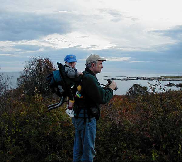
Photo by Allison Wells
East Point Sanctuary Trails, Biddeford Pool
When my husband and I were grad students conducting research in southern Maine during summers decades ago, Maine Audubon’s East Point Sanctuary became one of our go-to spots for birding. The parking is limited, but once parked, the idyllic rocky Maine coast lies before you. The trail into the 27-acre sanctuary leads along a golf course, but the path itself provides plenty of canopy and understory for birds. On a spring or fall morning, a walk along the longer loop might yield a dozen warbler species, including Yellow-rumped, Magnolia, Blackpoll, Blackburnian, and others. The trail opens up to more rocky coast, and at the tip of East Point, a pebbly shore abutted by sea-strewn boulders awaits. The shoreline, which consists of coarse sand and colorful pebbles, is a great place to explore with kids, we found when we had our son—he loved sifting through the sand and rocks for “buried treasure.” Views of the open ocean reveal flocks of eiders, including the occasional King Eider; Northern Gannets wheeling through the distant sky; Black Guillemots bobbing on the surf, and other sea birds. The trails are well traveled yet never crowded, with benches along the way for resting and taking in the seascape, including Wood Island Lighthouse just across the channel. This ocean outcrop, combined with thick vegetation interior to the trails, make the place a magnet for migrating birds, and many a rarity has been found here over the years. These include Yellow-breasted Chat, Surfbird, Western Kingbird, and Hooded Warbler. All of these special qualities make the trails at East Point Sanctuary among our favorites.
—AW
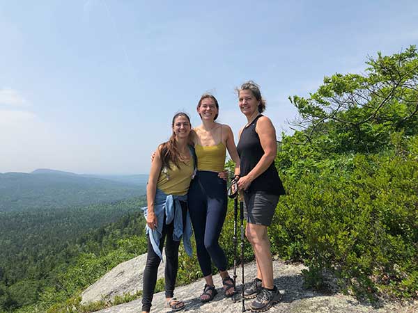
Photo courtesy of Ellerie Ezekiel
Day Ridges Preserve, Gouldsboro, Hancock County
Although I love an all-day hiking adventure—and Maine boasts many!—a majority of the time I spend in nature is on my favorite local trails. I’m fortunate to live within easy driving distance to numerous land trusts, and Day Ridges Preserve in Gouldsboro is a trail I hike with my family, friends, and adventure pup all year round. The trailhead is located just off Route 1, but it only takes a few minutes of hiking for the sound of traffic to dissipate, replaced by bird songs and the ambient rustling of leaves in the breeze. While there is an option to take the tote road all the way to West Bay Pond, I like to branch off onto the forested loop. Here, extensive bog-bridging provides the opportunity to explore a cedar swamp and wind around impressive glacial erratics. One of my favorite parts of revisiting this trail time and time again is watching how the environment changes both through the seasons and in response to an industrious beaver family that has made a home along the trail. One unique section of bog-bridging has had to be raised on multiple occasions as the beavers’ hard work morphs and shifts the wetlands. Frenchman Bay Conservancy cares for this preserve, and each time I hike this trail I’m struck by the careful balance between providing outdoor access while also allowing space for natural ecosystems to flourish.
—Ellerie Ezekiel, Frenchman Bay Conservancy
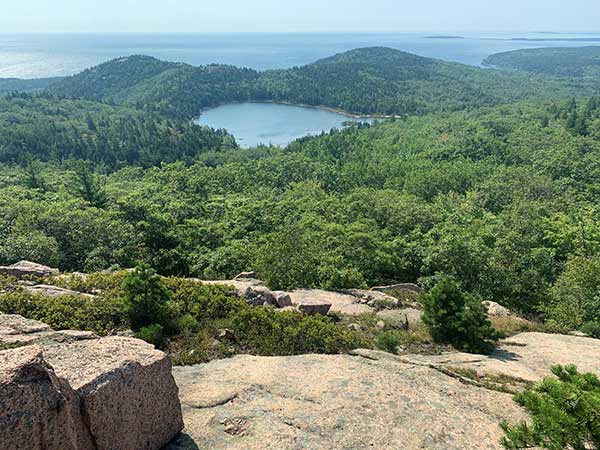
Photo by Pete Didisheim
Beechcroft Trail Loop, Acadia National Park
It’s hard to pick a favorite trail in Acadia National Park because there are so many great ones. But I am particularly fond of ascending the Beachcroft Trail up Champlain Mountain, where spectacular views can be had, then taking the Great Ridge Trail down to The Bowl for a swim, finishing at Sand Beach where an Island Explorer bus can take you back to the Visitor Center. Start the adventure by catching an Island Explorer Bus at the Visitor Center that will take you to the Sieur de Monts stop. A short walk through the woods gets you to the Beachcroft trail head, across Rt 3. The trail also is accessible from parking along Rt. 3 near The Tarn Pond. One of the wonderful features of this trail is the granite steps that ascend toward Huguenot Head—a veritable stairway to heaven. Continue onward to the top of Champlain Mountain for stunning views of Frenchman Bay, Bar Harbor, Schoodic Peninsula, the Porcupine Islands, and more. Continue onward down the Great Ridge Trail and you’ll end up at The Bowl, a wonderful spot for a swim. Be sure to bring a suit and towel, then hang out on the rocks to dry off before hiking down to Sand Beach for a walk before catching an Island Explorer back to the Visitor Center. If you want to extend the hike, take the Gorham Mountain Trail instead of dropping down to Sand Beach. Be sure to take the short Cadillac Cliffs side trail, which goes through some cool boulders. With this option, you can hike back along the Ocean Path, taking in Thunder Hole, and grabbing an Island Explorer from that spot. All round, it’s a wonderful hike with lots of highlights. A favorite, among many.
—Pete Didisheim, Senior Director of Advocacy
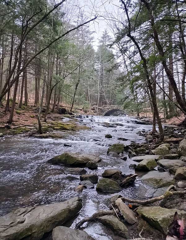
Photo by Codi Riley-Havu
Vaughan Woods, Hallowell
This property is managed by the Vaughan Woods & Historic Homestead and hosts a charming set of trails in downtown Hallowell. Once you leave the parking lot you quickly descend to Vaughan Brook and the first of two beautiful stone bridges over the brook known as the Driving Bridge. There is one primary loop, with several smaller loops you can take to add distance to your walk. This property provides a nice set of wide, fairly even trails in the Corniche Loop, and more rugged varied trails in the side trails that lead to the Stone Arch Bridge at the brook. The property is great in all seasons: spring gives you a raging brook with the spring melt, summer offers an opportunity to soak your feet and paws after the hike, fall is beautiful for the foliage, and winter provides everchanging and potentially challenging terrain. This is a great local favorite for a quick hike in Central Maine.
—Codi Riley-Havu, Gifts, Records, & Stewardship Coordinator
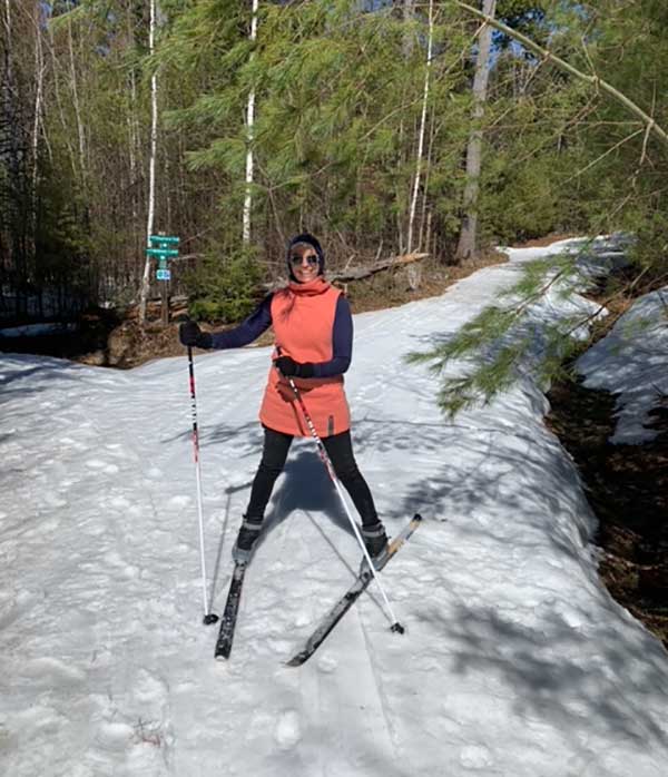
Photo courtesy of Lee Dassler
The Lunch Trail, Norway
Named in honor of Maine Beer Company’s beloved IPA, the Lunch Trail was, prior to completion, called the Farm to Town Trail because that is what it is, a 1.5-mile groomed Nordic trail connecting Roberts Farm Preserve to Main Street in Norway, mimicking a classic Scandinavian skiable village. The trail undulates along the contours of a serious wooded hillside providing intimate conversations with mature resilient trees whose bark and roots tell the stories of storms, droughts, and attacks from native woodland beings eking out a living or a home. Stone walls and the occasional embedded barbed wire portray the patterns of Norway’s agricultural past. Periodically the canopy or terrain opens to provide unexpected views of nearby hills, Pennesseewassee Stream, or Norway Lake. There are switchbacks and bridges—and one volunteer-managed mailbox with chocolates in it during ski season. Just east of the mailbox there’s an unlikely resident along the edge of the trail: a northern hackberry. Skiing the Lunch Trail is a roller coaster of joy, a blend of ups and downs, curves and straights, always beneath high canopy cover. Heading east into town provides a cross-country skier with a slight alpine thrill as the sloped trail lands on the level trailhead parcel. In the opposite direction, heading out of town after a nearby breakfast or lunch, the uphill exit provides a great opportunity to make room for more. The Lunch Trail is just for skiers in the winter, so there is a parallel trail called Janet’s Trail that is for snowshoers, snow runners, and dog walkers. In the summer, both trails are open for the walking and running world to enjoy. We like to take Janet to Lunch.
—Lee Dassler, Development Director, Western Foothills Land Trust
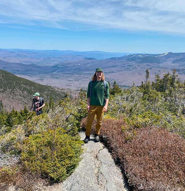
Photo courtesy of Josh Caldwell
Goose Eye Mountain Trail, Western Maine
Goose Eye Mountain is a hidden gem in the wild Mahoosuc Range, nestled along the New Hampshire border just north of Sunday River. Access to the exposed summit is most readily granted via the Wright Trail, which can be accessed just beyond the parking area for Frenchman’s Hole, an iconic swimming destination featuring a waterfall flowing over smooth rock into a deep basin. The Wright Trail follows the Bull Branch of the Sunday River past several other phenomenal swimming holes before crossing the stream to a tight, steep ascent up the northern face of Goose Eye Mountain. The trail tunnels through alpine forest until it spits hikers out onto a glorious ridge featuring Sunday River to the south, the Presidential Range to the west, and the 100 Mile Wilderness to the north. The sudden emergence onto open ridge and unimpeded views makes the steep climb all the more fulfilling. A short trot later, you’ll find yourself intersecting with the Appalachian Trail (AT) for the last segment to the peak. While tight in places and in need of signage and maintenance following this past winter’s storms, the Wright Trail is a delightful gateway to the AT, with many diverse features. Fair warning: the storms last winter did significant damage to the access road, so your hike may be longer than anticipated until the road to the parking area is fully repaired.
—Josh Caldwell, Climate & Clean Energy Policy Advocate and Outreach Manager

Photo by Betty Hartley
Brunswick Landing Perimeter Trail
One month into the pandemic, in April, 2020, I started cycling after 30 years of not being on a bicycle. Since then, I have pedaled more than 2,000 miles, with the largest percentage of those miles happening on the Brunswick Landing Perimeter Trail and surrounding area. Cycling on the road is not something I am comfortable doing, unless I know the road well and there are bike lanes. Brunswick is a great place to cycle, as there are bike lanes on many roads. The perimeter trail is not yet complete, but I like to ride it from Flight Deck Brewing’s parking lot, down Allagash Drive, onto the trail at the foot of the runway, and down to a solar array after passing through some forestlands owned by Bowdoin College. There are also some nice, quiet neighborhoods to ride through. For a longer ride, I pedal across Brunswick Landing onto Middle Bay Road and out to Simpson’s Point. From Simpson’s Point, coming back down Mere Point Road, with its nice bike lane, and through the Bowdoin College campus, back to the Perimeter Trail is one of my favorite rides on an early summer morning. Listening to the birds sing as I pedal along, usually with my mom (who will be 80 this year, and who often needs to let me catch up with her on our rides!) and a longtime friend, is the perfect way to spend an hour or two in Maine’s outdoors. When I want to stay closer to home, I also love riding the Kennebec Rail Trail from Gardiner to Augusta. If you have other bike trails to recommend, please send them to me at beth@nrcm.org.
—Beth Comeau, Communications Manager
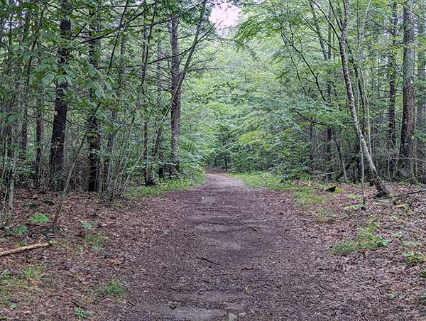
Photo by Betty Olivolo
Brave Boat Headwaters Preserve
Kittery Land Trust’s Brave Boat Headwaters Preserve, named after the nearby scenic harbor, is an important ecosystem on the coast of southern Maine. The biologically rich property is located next to Brave Boat Harbor in Kittery Point. The 100-acre preserve is one of the largest blocks of natural land remaining in Kittery. The property is home to rare and endangered species like the Blanding’s turtle, as well as wildlife like otters, which travel between the freshwater of the forested uplands to salt marsh and the sea. Easy 1.5 miles of trails of modest elevation provide access to approximately 60 acres. The conserved land spans from Brave Boat Harbor Road (Route 103) to Bartlett Road, connecting the US Fish and Wildlife Service’s Rachel Carson National Wildlife Refuge to Kittery Land Trust’s Norton Preserve. This easy wooded loop offers a look at the freshwater stream that feeds into the sea. The preserve is a popular trail for birding, cross-country skiing, and hiking, but you can still enjoy some solitude during quieter times of day. Dogs are permitted under voice control. This is a place where visitors can take a quiet walk or an invigorating cross-country ski, listen to birds, and lift their spirits; a place where kids and their families can encounter history in stone-wall-dotted woods, and where students and teachers can study Kittery’s unique coastal ecology.
—Dot Avery, Deputy Director, Kittery Land Trust
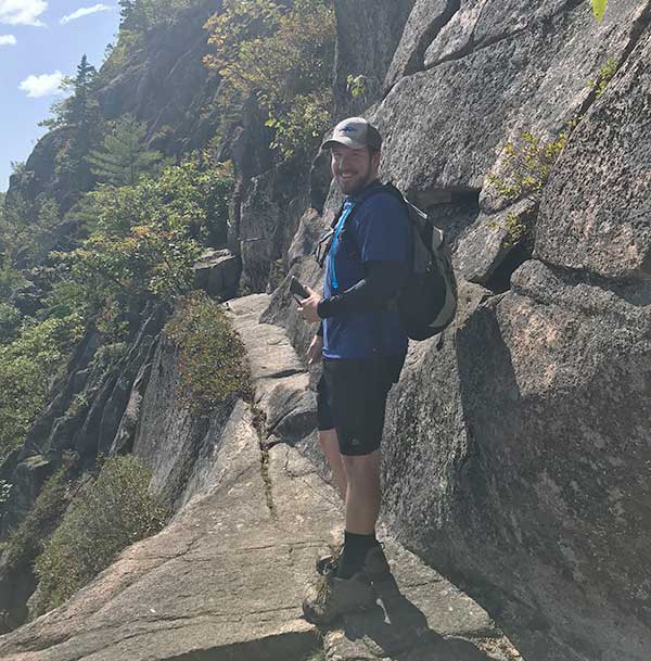
Photo courtesy Ben Wyman
Precipice, Champlain South Ridge, the Beehive, and the Bowl Loop Trail, Acadia National Park
By far one of my favorite hikes in Maine is the Precipice, Champlain South Ridge, and Beehive loop in Acadia National Park (ANP). Where else can you get ocean views while climbing up iron rungs and hugging the side of a mountain as you’re perched precariously on a ledge? While this famous loop needs little publicity with its location inside ANP, that does not diminish the technical challenges the loop presents. In my mind, it is one of the most exhilarating hikes in Maine along with Knife’s Edge in Baxter State Park. The length of the entire loop is 5.5 miles with 2,171 feet of elevation gain and priceless views. Be sure to wear appropriate footwear as this is not an easy loop to traverse, and hikers have been seriously injured or killed when attempting to tackle it in poor weather or with inadequate gear. Dogs are not allowed due to steep obstacles. The trail is closed from mid-April through mid-August to prevent disruption to the previously endangered Peregrine Falcons that nest along the cliff face.
— Ben Wyman, Administrative & Operations Associate
AMC Gravel Adventure Field Guide
Gravel bikes are one of the hot new trends in bicycling, involving wider tires that work well on gravel and logging roads. Maine has great gravel bike opportunities, as this attractive new guidebook from the Appalachian Mountain Club (AMC) demonstrates. This pocket-size field guide includes a dozen rides in the Moosehead Lake region, ranging from 2 miles to 111 miles. Each ride starts, ends, and/or passes by one or more of the AMC lodges in the region: Medawisla, Little Lyford, and Gorman Chairback. Order online at: GravelAdventureFieldGuide.com


