Exploring Maine’s Spectacular Federal Lands
Recently, a young man told me that he, his wife, and two kids live in a small house on a small lot in the Midcoast. He loves to get outside and said, “Public lands are all I’ve got.” At NRCM, we recognize the importance of quality time spent outside. Local land trust areas, state parks, and Public Reserved Lands all provide exceptional opportunities. Our work to establish a new national monument here in Maine, coupled with Acadia National Park’s 100th anniversary, has inspired us to put the focus on the spectacular federal lands found here in our state. From the southern coast to Aroostook County, they offer fantastic opportunities to enjoy the natural beauty, and peace and quiet, that make Maine such a special place. —Lisa Pohlmann, NRCM Executive Director
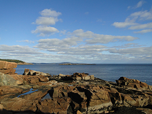
Acadia National Park by Beth Comeau
ACADIA NATIONAL PARK
Acadia is a dream world of tidal pools, rocky cliffs, quiet ponds, and sweet- smelling forests. Despite its popularity, there are plenty of hikes where you will see few people, even on the busiest summer days. I have several favorite spots. The first is “Wonderland,” a shoreline path on the quiet side of Acadia, near the Seawall Campground. A short hike through this fairyland forest brings you to the kind of rocky coast that makes Maine famous, with plenty of places to sit on a granite shelf, enjoy a quiet lunch, and take in scenic ocean views. Then there are the Carriage Trails where I have cross-country skied when the summer crowds were gone and all that surrounded me was the still whiteness of snow. Last October I spent a gorgeous fall day with friends, biking those crushed gravel paths through forests, past secluded ponds and bubbling streams, and under stone archway bridges. And of course Thunder Hole, right off Park Loop Road, is a must-not-be-missed example of the powerful Atlantic when she rolls into this naturally formed inlet, sending up a rumbling roar and spume of water that can be 40 feet high, splashing and thrilling viewers. Acadia generates more than $200 million in economic benefit for communities surrounding the park and supports more than 3,000 jobs in the local area. It is a wonderful reminder of why national parks are America’s best idea. —Lisa Pohlmann, NRCM Executive Director
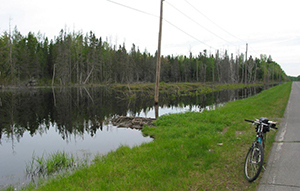
Aroostook National Wildlife Refuge by Bill Sheehan
AROOSTOOK COUNTY NATIONAL WILDLIFE REFUGE & MOOSEHORN NATIONAL WILDLIFE REFUGE
As a 32-veteran of the Maine Park Service that included duties at Aroostook State Park in Aroostook County and Cobscook Bay State Park in Washington County, I have been privileged to experience the outstanding natural resources at the Aroostook National Wildlife Refuge (NWR) in Limestone and the Moosehorn National Wildlife Refuge in Baring and Edmunds. Aroostook NWR, only four miles west of Limestone, is reclaimed from a former Air Force base. It provides valuable forest and grassland wildlife habitat among a surrounding landscape of plowed fields and agricultural crops. Ponds and streams offer a home to a variety of migratory birds, though the majority of the refuge is forested upland habitat where moose thrive and migratory songbirds breed. The grassland sections are home to a population of state-threatened Upland Sandpipers; the refuge also hosts boreal specialty species like Boreal Chickadee, Gray Jay, Mourning Warbler, and others.
Aroostook is a sister refuge to Moosehorn National Wildlife Refuge and is located southwest of Calais. It also has a unit near Cobscook Bay State Park, 20 miles east of Machias. The area supports many wildlife species, and it is common to see nesting Bald Eagles in both the Baring and Edmunds units. About a third of Moosehorn is designated wilderness with a hands-off approach to management. Such philosophy allows the areas to develop into old-growth climax forests that support special species such as Cape May and Bay-breasted warblers, Spruce Grouse, and White-winged Crossbills. I’ve enjoyed hiking the Weir and South trails in Edmunds and early-morning fly fishing trips on Hobart Steam, not to mention many nights sitting quietly during a spring evening and listening to the mating song of the American Woodcock, known to many as the “timberdoodle.” Nothing compares to sitting in the twilight and hearing that brief “preent, preent” call and watching the bird spiral into the air. At 250-300 feet up, he begins a sky dance, descending in a motion as gentle as a falling leaf, until he lands near the spot from which he launched, all with the goal of attracting a mate. Given busy lifestyles, a visit to a refuge is a great way to rejuvenate, refresh, and return home, physically and psychologically healed. Several years ago I was speaking at a nursing home and at the end of my presentation an old gentleman hobbled up on sore knees and said, “You know, Tim, my legs are weak and I can’t wander our refuges much anymore, but lord, it does my heart good to know they are there.” —Tim Caverly, NRCM member, Millinocket
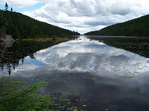
Speck Pond, near the top of Old Speck Mountain by Linda Woods
APPALACHIAN TRAIL: MAHOOSUCS TO OLD SPECK
On a June weekend years ago, I hiked the Mahoosucs from south to north to Speck Pond, with a good friend of mine. The Mahoosucs are south of Old Speck, which is more directly reached from ME Route 26, the Grafton Notch area. We drove around to New Hampshire and found the trailhead off NH Route 16 and up some logging roads. We loaded up our packs and hiked up the two miles to the intersection with the Appalachian Trail (AT) without seeing a single soul. It was sunny but still cool, as only June can be, and the hiking was lovely. We reached the AT and the Notch just shy of noon, using every muscle. A stunning, glacier- carved gorge wound through granite cliffs, pockets of snow and ice still hidden among the crevices, and water burbled somewhere down there, too. The views were stunning, and we stopped frequently to look back at where we had been. The greens were the fresh greens of spring, the balsams still showing their young, green tips. By the time we made it to Speck Pond we were sweaty and tired. After a dip in the pond, we set up our tent on a platform not far off the trail and almost immediately the blackflies came out. We couldn’t get in the tent fast enough! We rose early the next morning and headed down the Speck Pond Trail to the road and back to our car. All in all, a nice woodland hike and an experience I will always remember. —Leslie Burhoe, NRCM Executive Assistant
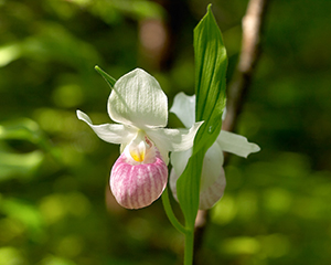
Showy lady’s slipper by Pam Wells
SUNKHAZE MEADOWS NATIONAL WILDLIFE REFUGE
In early July, I set off on one of my annual quests. Off the trail, off the beaten path, deep into the forest toward a boggy area of Sunkhaze, I am in search of showy lady’s slippers. They and a few yellow slipper friends have adopted this region of the refuge. Dark and damp, it has the necessary habitat that the showy lady’s slippers require in order to survive. Showy lady’s slippers are but a small taste of what Sunkhaze Meadows National Wildlife Refuge provides to visitors. At 11,485 acres, Sunkhaze offers a variety of visitor activities that include hunting, fishing, paddling, and wildlife viewing as well as a plethora of photography opportunities. Moose, deer, amphibians, and reptiles routinely use Sunkhaze as their home each year. More than 200 species of birds have been documented here; as spring migrants return, the refuge becomes an avian hotspot where one can listen to warblers and a host of other feathered singers. Parking areas and trails allow visitors easy access. Off County Road in Milford, Carter Meadow Road, Oak Point Trail, and the Johnson Brook Trail system are open for visitors. Each offers a different sort of forest environment, with Oak Point and Carter Meadow trails taking you to the edge of Sunkhaze bog. On the Studmill Road side, visitors can visit using the Ash Landing Trail and the McLaughlin Road access point. While Ash Landing gets you quite quickly to Sunkhaze Stream, McLaughlin Road provides several options for off-the-main- road trails. As I near the mile mark, I see my stunning orchid quest ahead. Despite the sloshing and crawling over fallen rotted trees, this yearly adventure is always worth the effort. We are fortunate to have this diverse, large national wildlife refuge in our backyard. While it doesn’t boast the quantity of visitors that many other refuges experience, Sunkhaze is a wild, untamed place that is well worth the adventure for those who love the outdoors.—Pam Wells, NRCM member, Old Town
Morrison Brook, Caribou-Speckled Wilderness, by Tony Marple
CARIBOU-SPECKLED WILDERNESS AREA
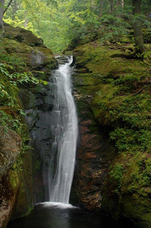
A hike up East and West Baldpate followed by a swim at Screw Auger Falls on Route 26 is an annual ritual of mine. A few years ago, I was looking for a new hiking adventure in western Maine. I was pleasantly surprised to find Speckled Mountain in the Caribou-Speckled Wilderness Area, on the Maine side of the White Mountain National Forest. To find the trailhead for Speckled Mountain from Route 202 in Gilead, travel south on bucolic Route 113 for 10 miles to the parking area at the Brickett Place. From Route 302 in Fryeburg, travel north on Route 113 for 19 miles to the Brickett Place. Speckled Mountain boasts a six-mile loop trail with nice views from its expansive, “bald,” 2,877-foot summit. From the Brickett Place parking area, I recommend starting your loop hike on the Bickford Trail. The trail meanders past gurgling waterfalls and flumes that beg to be photographed. The falls run well into autumn and are truly spectacular. In addition to the summit, the numerous waterfalls, natural waterslides, and chutes are the highlight of the hike. The trail continues with modest elevation gains for another three miles on the Blueberry Ridge and Bickford trails to the summit. Looking west toward New Hampshire, several mountains in the Presidential Range lay before your eyes, including a glimpse of Mount Washington. Looking east across Maine, you’ll notice picturesque Kezar Lake spread out before you. After taking in the views, continue on the loop trail by following the rock cairns and descend via the Bickford Trail. The trail is steep and muddy in places so use extra caution. For the last mile, the trail follows scenic Bickford Brook back to the parking lot. Happy trails! —Todd Martin, NRCM Grassroots Outreach Coordinator
Orin Falls, accessible from the IAT, by Emmie Theberge
THE INTERNATIONAL APPALACHIAN TRAIL EAST OF BAXTER STATE PARK
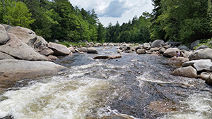
The International Appalachian Trail (IAT) passes through the lands proposed as a new National Monument/National Park, east of Baxter State Park and west of the East Branch of the Penobscot River. Elliotsville Plantation, Inc. (EPI) proposes to donate 87,500 acres to the American people as a National Monument, as a first step to a National Park and Recreation Area. These lands include many beautiful places and recreational opportunities including hiking, biking, fishing, wildlife watching, and paddling in the summer, and cross-country skiing and snowshoeing in the winter. Spectacular views of mountains, forests stretching to the horizon, huge trees, gorgeous waterfalls, raspberries and more raspberries—these were some of the highlights of the 4-day, 25-mile hike my husband and I took in August on the IAT, 35 miles of which run through the proposed National Monument/National Park. On the lower slopes of Deasey Mountain we saw some of the biggest hemlock trees I have seen in Maine. The undergrowth was sparse, having been shaded out by the magnificent hemlocks. Along tiny rivulets, every rock was thick and soft with moss. Side trails allow you to climb Barnard Mountain for a great view of Katahdin. Hike upstream to Orin Falls on Wassataquoik Stream, which flows out of the heart of Baxter State Park. There you can climb on boulders or cool your feet in the pristine, fast-flowing water. We hope this area will be designated a National Monument in 2016, the 100th anniversary of the National Park Service. A National Monument is similar to a National Park, but it can be created by the President of the United States, rather than by an Act of Congress. A National Monument would provide generally the same level of protection and recreational opportunities that a National Park does. You can hike the IAT either south to north, or north to south. A good starting place in the south is where the trail leaves the scenic Katahdin Loop Road on the EPI land. On the north end, you can start (or end) at the gate on the Messer Pond Road, or where the trail crosses the Grand Lake Road heading in to Baxter’s north gate. Many outfitters in the region will be happy to shuttle your vehicle from one end of the trail to the other. Happy hiking! —Cathy Johnson, NRCM Forests and Wildlife Director
Timber Point, Rachel Carson National Wildlife Refuge, Kennebunkport, by Allison Wells
RACHEL CARSON NATIONAL WILDLIFE REFUGE
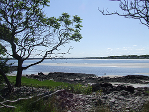
Some of the best birding locations in southern Maine are parts of the Rachel Carson National Wildlife Refuge (RCNWR), made up of at least 11 separate land parcels that stretch along 50 miles of coastline from Cape Elizabeth south to Kittery. The northernmost section is at Spurwink Marsh in Cape Elizabeth. The marsh and brushy edges can be viewed from a number of access points where herons, egrets, ducks, and shorebirds may be seen. Another hotspot is Biddeford Pool, with coastline and saltmarsh surrounding the large tidal pool for which it is named. Biddeford Pool is famous among birders for hosting an abundance and diversity of shorebirds, especially from mid-July through October. A trail that skirts the edge of the private parking lot across from the entrance is a favorite among birders to get to the edge of the marsh to scope for shorebirds, especially just before or after high tide when the birds are more concentrated. A new addition to the refuge lies just south at Timber Point, where a trail along the Little River leads to a point with an overlook of Goose Rocks Beach in Kennebunkport. This trail can be rich with landbird migrants in spring and fall; in summer, terns feed at the mouth of the river, and herons and egrets feed in the salt marsh. Parking is available at the end of Granite Point Road in Biddeford, where the 1.25-mile trail begins.
The headquarters of RCNWR is in Wells on Route 9 about a half-mile north of the intersection with Route 1. Here, a mile-long trail leads through pine forests where Pine Warblers trill throughout the summer; at the salt marshes, listen for nesting Willets giving their loud “pill will willet” calls. One last favorite refuge access spot is along the short road to Wells Harbor, near the fire station along Route 1 in Wells. Pull off along the road to scope for Saltmarsh Sharp-tailed Sparrows, herons and egrets, sandpipers and other shorebirds in the salt pans. Behind the municipal parking lot and playground near the harbor, there is a short trail through a narrow strip of woodland where migrant songbirds can sometimes be found and that provides more views of the marsh. In winter, the harbor itself might allow nice looks at Common Loons, Horned Grebes, and a variety of wintering bay and sea ducks. One year a rare King Eider appeared here, to the delight of many birders. Good birding! —Jeff Wells, NRCM member, Gardiner
Umbagog National Wildlife Refuge Karen Herold
UMBAGOG NATIONAL WILDLIFE REFUGE
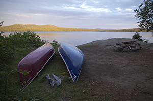
Umbagog is a preserve of wetlands, forest, and a seven-mile-long lake on the Maine-New Hampshire border, northwest of Bethel. With campsites widely spaced along the lake and on islands, Umbagog is a perfect destination for a relaxed and gorgeous canoe trip. A combination of holdings by the US Fish and Wildlife Service, the State of Maine, and the State of New Hampshire protects shoreline along Lake Umbagog and the Androscoggin, Magalloway, and Rapid rivers nearby. Reserve a lake campsite through the New Hampshire State Parks. Launch at the campground on Route 26 just over the state line. The lake paddle gives you long views of forested hills and undeveloped shoreline. Though having a reservation makes the paddling relaxed, the long reach of the lake can make for big waves in wind. Another approach is to start the trip on the Magalloway River. Sixteen miles of flatwater begins at the Route 16 bridge in Wilson’s Mills, though you can put in at points farther down for a shorter trip. Gliding down the winding river, through the marsh, and then onto Lake Umbagog offers a day of varied paddling. It’s a good idea to reserve a campsite close to the Magalloway’s entrance to Lake Umbagog because the day can be long, and you will want to save time for swimming. Greedy to experience it all, I ran out of time on my first trip to Umbagog. After the time-sink of setting up a shuttle and figuring out the put-in, we enjoyed the long paddle on Magalloway and the eagles overseeing the marsh before the lake. Dusk was setting in as we looked for our campsite. Any site would have been lovely, but we didn’t want to land somewhere and find out later that we had set up on someone else’s territory. All was well, however, and all worries washed away with the first plunge into the lake. A day trip once you’ve set up on an Umbagog campsite could involve a visit to the Rapid River, which enters the lake on the eastern side. Bring a fly rod! —Karen Herold, NRCM board member
Evan’s Notch sign by Beth Comeau
WHITE MOUNTAINS NATIONAL FOREST
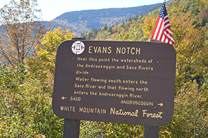
I am often surprised by how many people do not know that the White Mountain National Forest extends into Maine. In fact, about 40,000 beautiful acres of the 800,000 National Forest can be found just southeast of Bethel. Among my favorite hikes on the “Maine side” of the Whites is Blueberry Mountain. From the Bickford Brook trailhead on Route 113, I recommend combining the Blueberry Ridge and the Bickford Brook trails to form a somewhat leisurely 7.6-mile loop. This is a great fall hike, with multiple views of Evan’s Notch and into the Whites from the trail’s rocky ledges. In the winter, my family and I love to ski Route 113, which is closed in the winter to cars. The route takes you gradually up into Evan’s Notch. Route 113 is gradual enough to not require skins or super-human effort, but steep enough for a very fun, rewarding ski when you double-back to your car at the end of the day. We enjoy this ski trip because it is accessible, perfect for a shorter day, and great in early winter—it only takes 6 to 8 inches of accumulated snow for the Route to be skiable. The White Mountain National Forest was formed under the Weeks Act of 1911, in which the U.S. Congress authorized the Secretary of Agriculture to purchase lands deemed necessary to protect headwaters in the eastern United States. Evan’s Notch is drained by the Cold River and eventually leads to the Saco River and flows into the Gulf of Maine. —Eliza Donoghue, NRCM Forests and Wildlife Policy Advocate and Outreach Coordinator
Kayaks on Halifax Island by Emmie Theberge
MAINE COASTAL ISLANDS NATIONAL WILDLIFE REFUGE, INCLUDING HALIFAX ISLAND
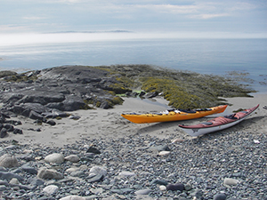
The Maine Coastal Islands National Wildlife Refuge is made up of more than 50 remote islands and mainland sites. The area spans the length of Maine’s coastline, including several special places Downeast. These lands are vital nesting grounds for seabirds, wading birds, and Bald Eagles; the inland sites support migratory songbirds, shorebirds, waterfowl, and other wildlife. In the summer of 2013, I had the great pleasure of sea kayaking from Bar Harbor to Machiasport and was able to enjoy many of these special places along the way, including Petit Manan, Bois Bubert Island, Brothers Island, and my favorite, Halifax Island, an outer island in the Roque Archipelago in Englishman Bay. This publically owned island is managed by the US Fish and Wildlife Service and is also along the Maine Island Trail. The best way to enjoy Halifax Island, like most of the Maine Coastal Islands, is by boat! The mainland sites are all Downeast and can be accessed by car. Halifax Island will always be a special place for me. My partner and I spent the night on Halifax at the end of a seven-day sea kayak paddle from Bar Harbor. After paddling for a week along the Downeast coast, this tranquil island was a stunning place to spend our last night. After arriving, we set up camp, took a quick swim, then walked around the entire island as the sun was setting. A ringlet of fog laced the nearby islands, and the water was calm. Like many wild islands in Maine, Halifax is ecologically unique and an important habitat, so we took great care as we walked. You can access Halifax from Roque Bluffs State Park or from other boat landings nearby. This public island is open for careful day use all year. Primitive, leave-no trace camping is permitted with prior permission, but please be prepared to carry out all waste. This island is yours and mine to protect for future generations and is precious habitat for Maine’s iconic seabirds. Enjoy! —Emmie Theberge, NRCM Rising Director and Clean Energy Policy Advocate


