The Push for Protection: Saving the Allagash
by Doug Watts
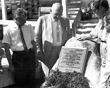
State-protected Allagash River becomes federally designated wild and scenic river.
Photo taken July 1970. Senator Ed Muskie is on the right.
Conservation of the Allagash River is what brought together the founders of the Natural Resources Council of Maine (NRCM), at a time when the river was threatened by dams. Since its founding in 1959, NRCM has continued to be at the forefront of efforts to preserve the unspoiled wilderness character of the Allagash River watershed. “Like Katahdin and Acadia, the Allagash is one of Maine’s exceptional natural treasures, and creating the Allagash Wilderness Waterway is one of NRCM’s most important and enduring achievements,” says Brownie Carson, who was executive director of NRCM for 26 years. He adds, “I love paddling the Waterway and knowing that it will be there for generations to come.”
On November 9, 1966, the Bangor Daily News reported, “Maine people gave a booming vote of approval to a unique plan to place a wild river under state control forever, for the recreational use of the public—the fabled Allagash … The money for the Allagash bond issue will be spent mostly to buy a narrow strip of land along the shores of the various lakes and riverways in a 100-mile-long corridor near the upper St. John River, not far from the site of the controversial Dickey-Lincoln School hydroelectric project. The State Parks & Recreation Commission will govern the ‘Allagash Wilderness Waterway,’ controlling access to its lakes and streams to preserve its forest, its fishing and its unspoiled beauty.” The article goes on to describe a plan that had been developed over several years by many conservationists and sportsmen, who became the founders of the Natural Resources Council of Maine. The final act was drafted by a legislative committee and sheparded through the Legislature by Democratic State Senator Elmer H. Violette.
NRCM led efforts to convince the Legislature to create the Allagash Wilderness Waterway, through the vote and bond issue. In 1962, the organization hired experts to undertake a thorough analysis of the value of protecting the area. The results of this study boosted support for protection, and, in 1963, the Maine Legislature established the Allagash River Authority to create a plan for conserving this special region.
A Different Time
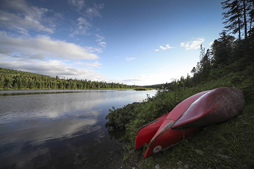
Boats on the Allagash, photo by Laurie Haag
In 1857, when Thoreau wrote about his canoe trip down the Allagash, the outlets of its big lakes were blocked and flooded by log driving dams, which caused acres of dead trees (“dri-ki”) to make tangled, windblown masses along the submerged sand beaches. Wolves were nearly gone; moose and caribou were on their way out. Most of the sentinel white pines had been cut down. A century later the U.S. Army Corps of Engineers proposed to turn the entire Allagash River into a long, snaky, shallow, weedy reservoir via a dam at a spot called Rankins Rapids.
At the time when Maine voters cast ballots to issue the $1.5 million bond to purchase the waterway and permanently protect the wilderness character of the Allagash, the front page of the November 9, 1966 Bangor Daily News featured an ad for rubber pack boots on sale for $3.29 at Schiro’s Shoes—and shared the news, “Bay State Negro Elected Senator.” Whatever else may have been happening around the state, Maine people showed strong support for the referendum authorizing the State to issue the bond. The statewide margin on the vote was 60:40 in favor. Even in Aroostook County, “yes” beat “no’’ 21,709 to 19,530. In 1970, the waterway became part of the National Wild and Scenic Rivers System.
Left unstated in the news stories of the time was that some people suggested that preservation of the Allagash River should be a quid pro quo for consent to damming and flooding its companion river, the upper Saint John. While Maine voters approved saving the Allagash River, the newly elected governor, Kenneth Curtis, had campaigned on a platform of damming the entire upper St. John River as “vital to Maine’s future.”
Lost in old headlines on microfilm is that the damming of that section of the St. John River upstream of the confluence with the Allagash was a near fait accompli. One of NRCM’s founders, Clinton “Bill” Townsend, recalls one of Senator Edmund Muskie’s staff members suggesting that if NRCM would not oppose damming the upper St. John River, the Allagash would be spared. “We refused it,” Townsend says. Putting the pieces together to preserve the Allagash from dams took NRCM and its partners nearly a decade. Townsend credits another NRCM founder, Bob Patterson of Mt. Desert Island, and Maine Senator Ezra James Briggs of Caribou as key leaders of the effort, which culminated in the November 1966 referendum vote. “The National Park Service wanted to preserve the Allagash, but the forest owners hated it,” Townsend said.
Long-time NRCM member John McKee, a professor at Bowdoin College in the mid-1960s, adds, “The only option for citizens at the time was to slow the process down.” At this time, no federal environmental laws existed; entire rivers could be dammed by administrative or legislative fiat. McKee recalls a mid-summer meeting by the Army Corps that took place around 1965. “It was a hot day in August. The man from the Army Corps talked about campsites on the new lake they would make where you could catch yellow perch. We asked the Corps to study the issue some more. They said they had already studied it to death. We told them, ‘You studied the wrong stuff.’ We believed the sheer economics of the project would make it fall apart.”
Over the years, cost estimates for the project escalated to $900 million, and support among Maine’s elected officials eroded. In 1978, Governor James Longley told President Jimmy Carter, “We do not have a right, in this generation, to commit a significant portion of our valuable wilderness land to a project based solely on the fact that it will temporarily stimulate the economy by a construction boom …” In the fall of 1984, after a battle that lasted two decades, the Dickey-Lincoln Dam project was finally killed by a vote in the U.S. Congress.
What Remains
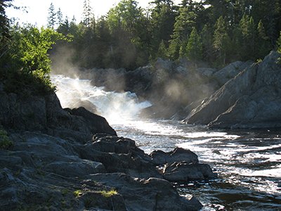
Allagash Falls, photo by Brownie Carson
In some ways the Allagash is both less and more explored than it was 50 years ago. Logging roads now follow it for miles; it is now possible to drive to the Allagash in a way that had not been possible in years past. Satellite phones now allow relatively quick and easy access to a Life-Flight helicopter in cases of injuries incurred while paddling. GPS innovation means explorers no longer have to rely
totally on topographical maps to get an idea as to where they are. And satellite technology lets anyone scan the entire Allagash down to the resolution of a canoe; in doing so, they can see that what is just outside the 500-foot strip of land bought by the voters of Maine more resembles a jig-saw cornfield of young trees than a trackless, forested wilderness—the global economic forces that turned the giant pines of the Allagash into stumps in the 1840s are as relentless today.
Since the moment of its conception by NRCM founders and later, the Allagash Wilderness Waterway has been knotted in a messy debate about what the words “wilderness” and “waterway” should mean. But these issues miss a larger point: in 2016, on its 50th anniversary, despite harvesting and logging roads, the Allagash remains one of the wildest places in the United States east of the Mississippi. No paved roads go near it; there are no interstate highways in the vicinity, nor are there outlet malls or vacation resorts. There are no cities or towns in the Allagash Wilderness Waterway or even the tiniest village. Given that the debate from 1955 to 1966 was whether the Allagash River would be drowned, latter-day debates about boat-launches and dirt-road access to the river seem small until you realize that wilderness character can easily be eroded by a series of seemingly insignificant decisions. Nobody would argue that the character of Mount Katahdin would not be irrevocably changed if a two-lane auto road were built up its spine.
The tensions today in the Allagash have changed little over the course of time. What has changed is that a state law led by citizens was put in place in 1966 and a federal law added further protection in 1970. Both remain in place today, to protect the primary public value of the Allagash and the preservation of its wild character for now and for future generations.
Writer Douglas Watts of Augusta is a lifelong river-lover who worked with NRCM early in the campaign to remove the Edwards Dam to restore the Kennebec River’s fisheries.
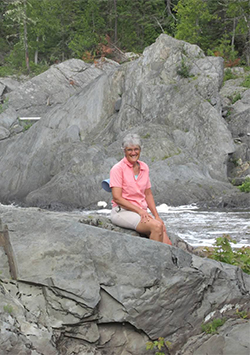
NRCM Executive Director Lisa Pohlmann, photo by Elaine Isakson
“I’ve canoed the Allagash River twice – so far – and it is a paddler’s dream. There are few places in the eastern U.S. where I can disappear for days on a river that winds through nothing but trees and lakes, with mountains on the horizon, and nothing to distract me except a moose in the morning or loons at night. On the Allagash I’ve experienced glorious sunshine as my pals and I stopped for lunch and swam with the current. I have endured slashing rain bursts that had us huddled, laughing and shivering on the shoreline. I’ve looked up at the dark night sky full of stars and pondered our place on this precious planet. I am honored to now be leading the organization—NRCM—whose founders got together to protect this very special river, and then kept right on going to engage in countless campaigns to protect the environment across the state. The Allagash River would not be the same without the guardianship of the citizens and staff who made up NRCM back then. In fact, the entire state of Maine would not be the same without the role that NRCM has played for the last 57 years.” —Lisa Pohlmann, Executive Director, NRCM
A Wilderness Girl and Her Wilderness Waterway
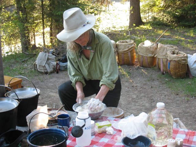
Alexandra Conover Bennett on NRCM trip on the Allagash Wilderness Waterway. Photo by Brownie Carson
Alexandra Conover Bennett grew up in the once rural, apple-orchard town of Stow, Massachusetts, with cousins in Cutler, Maine. By 19 she was looking for “inland” canoeing adventures. A girlfriend’s mother said on a lark, “Go up to the Allagash.” This was in 1972 and Alexandra did—her first trip by snowshoe along the wintry waterway. By the early 1980s, Alexandra and her partner Garrett Conover were premier guides on the Allagash Wilderness Waterway, making three to four full-length trips per year (summer by canoe, winter by snowshoe) for 30 years.
When asked what changes she has noticed most on the Allagash Wilderness Waterway, Alexandra says, “The two changes I’ve noticed most in the past 40 years are that there is now a labyrinth of roads along the Allagash, and that ice out is much earlier and ice-in is much later. We can’t do snowshoeing trips now where and when we could 20 years ago because it is freezing up much later and river ice is unpredictable.”
A diligent diarist, Alexandra has kept copious field notes for every canoe trip down the Allagash. One observation, she said, led to the discovery of a previously unknown variant of a wildflower in the St. Johnswort family, which she noticed by an unusual, spicy smell from one small spot along the Allagash banks. “Every time we paddled by this place, we noticed a peculiar fragrance. After several years of noticing it, we finally pulled ashore to see what plant was making it,” she said.
A second revelation required simple but repeated diary entries every snowshoeing season for 30 years: coyote tracks in the snow. “My notes going back to 1980 show that the size of coyote tracks and the stride length has gotten bigger over time,” she said.
Alexandra and Garrett Conover have taken hundreds of people from all over the world down the Allagash. “I have watched white-collar, high-level businesspeople go through a change during one trip,” she said. “They’ve told me they feel alive and real. After a trip, I’ll tell people that once they get back, there is going to be a transition, and it might feel odd for a few days.” She adds, “This is a place that heals humans. You grow very fond of it, probably because of all it gives.”
When asked what she could say or hope for the next 50 years on the Allagash River, she related a story about bringing a native and lifelong resident of Allagash Village to a public hearing in Augusta about the future of the Allagash. “His name is Wilmer Hafford. Once arriving at Augusta from the very long drive, Hafford gave laconic testimony. He told the legislative committee, ‘Do what’s best
for the river. The river knows best.’”
She adds, “It’s taken me a long time to really understand what Wilmer meant. I think what he said is that if we take care of every bit of river, then it can take
care of us.” —by Doug Watts


