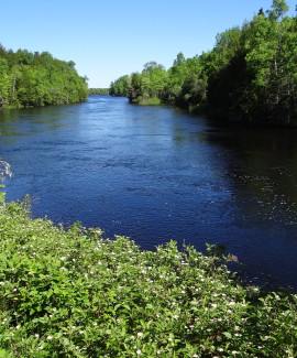
St. Croix River
Since 1992, the Land for Maine’s Future (LMF) program has funded five projects along Spednic Lake and the upper St. Croix River, working with the Province of New Brunswick to preserve an exceptional, undeveloped corridor along the U.S.-Canada border.
he LMF projects have protected more than 4,100 acres of land and 72 miles of shoreline along the Maine side of this international waterway. New Brunswick has matched this initiative by protecting 100 miles of facing shorefront and considerable backlands.
Spednic Lake, one of Maine’s largest undeveloped lakes, has prominent glacial features and forested shores enjoyed by the fishermen and paddlers who ply its waters. The St. Croix is one of Maine’s most undeveloped rivers, and a 33-mile segment along the upper river is a renowned destination for backcountry canoeing. Both the lake and river provide essential habitat for Bald Eagles, wild landlocked salmon, smallmouth bass, and many regionally significant plants.
In 1992, the LMF program first supported acquisition of a 523-acre peninsula between Spednic and Mud Lakes augmented by a 1995 purchase on Mud Lake. In 1994, the program funded the acquisition of a 500-foot shoreline easement along 16 miles of Spednic Lake and the fee acquisition of 11 islands from the Baskahegan Company. Then in 1998, working with the Woodie Wheaton Land Trust, the LMF program funded the State’s acquisition of Spednic’s Birch Island.
In 2003, the LMF program helped to acquire 2,817 shoreland acres (with 49 miles of waterfront) on Spednic Lake and the upper St. Croix River. This project involved the New England Forestry Foundation, Woodie Wheaton Land Trust, Maine Bureau of Parks & Lands(BPL), Maine Department of Inland Fisheries & Wildlife (IF&W), the Province of New Brunswick, and the St. Croix International Waterway Commission.
The St. Croix International Waterway Commission manages LMF project lands and easements on Spednic Lake and the St. Croix River.
Closest Town
Vanceboro
Activities
Bird & other wildlife watching, hiking, snowshoeing, cross-country skiing, backcountry camping, hunting, fishing, canoeing, and kayaking
Region
Downeast Maine – Hancock & Washington
Acres
4,188
Directions from nearest town
DeLorme Maine Atlas and Gazetteer Map 36, A-3; Map 45 A/B-5; Map 46 B-1/2/3, C-2/3, D-2/3, E-3. Both Spednic Lake and the St. Croix River can reached from access points in downtown Vanceboro. The most popular St. Croix River trips are Vanceboro to Loon Bay (20 miles) and Vanceboro to Grand Falls Flowage (33 miles). For information on other St. Croix canoe trips, see the Maine Rivers website.


