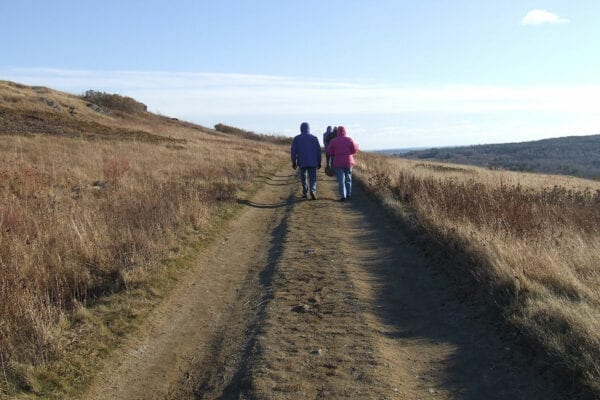
Hiking up Beech Hill by Allison Childs Wells
A short walk up Beech Hill rewards one with panoramic views of the Midcoast, stretching from the Georges River Valley out to Monhegan Island and east to Mount Desert Island. Generations of local residents have frequented Beech Hill–enjoying family hikes and picnics, blueberry-picking, and quiet reflection in an inspiring setting. This cherished community landmark is now permanently protected, thanks to the generosity of the former landowners, community donors and the Land for Maine’s Future (LMF) program.
As with many LMF projects, the conservation of Beech Hill occurred in stages. The first easements — limiting future construction on the land — were placed on the property more than 20 years ago. The former landowners then added further protective covenants to preserve the property’s scenic and ecological values, and helped to stabilize a Norwegian-style stone cottage at the summit (known as “Beechnut”) which was built in 1915.Wanting to see the land conserved and accessible to the public, the former landowners offered to sell 295 acres surrounding the summit to Maine Coast Heritage Trust for a price well below the appraised value. MCHT later transferred the property to Coastal Mountains Land Trust retaining a conservation easement on the land that prevents future subdivision and allows public access and sustainable agriculture. Coastal Mountains Land Trust has opened new trails for walking and cross-country skiing that enable visitors to enjoy the property without intruding on the 75 acres of organic blueberry fields. The blueberry operation will keep the fields open, helping to maintain the views and provide essential grassland habitat for killdeer, bobolinks, and certain sparrow species that are in decline nationwide.
Watch an aerial video of Beech Hill Preserve here.
Closest Town
Rockport
Activities
Bird & other wildlife watching, hiking, dog walking (on leash), hunting (permitted in the forested areas of the Preserve only), snowshoeing, and cross-country skiing
Region
Midcoast Maine – Sagadahoc, Lincoln, Knox, Waldo
Acres
295
Directions from closest town
DeLorme Maine Atlas and Gazetteer Map 14, D/E-3. There are two trailheads leading to the summit. The trail from Beech Hill Road is roughly half the length (.5 miles one way) of the one from Rockville Street. From Rockport (at Routes 90 and 1), take Route One south about 1/3 mile, turning right on Beech Hill Road. The parking lot is on your left after 1.25 miles. To reach the Rockville Street parking lot, proceed south on Route One for 1 mile past the Beech Hill Road intersection, turning right onto Rockville Street (and right again in .2 miles), and proceeding .5 miles to a parking lot on your right.


