In honor of the 50th anniversary of the Endangered Species Act, the Natural Resources Council of Maine is partnering with Maine photographer Nathaniel Child on a blog and photography series to bring awareness to some of Maine’s threatened and endangered species and their habitat. Passing the Recovering America’s Wildlife Act (RAWA) would help state and wildlife agencies conserve priority habitat for at-risk wildlife. Click here to read all the stories in the series.
As I settle down into my sleeping bag for the night, I hear the mournful wolf-like wail of a Common Loon echoing over the waters of Wadleigh Pond while the light of the full moon creates leaf-shaped shadows on the rain fly of my tent.
I’m nearly 25 miles from the nearest paved road, and even farther from anything resembling civilization. My campsite is deep in the middle of the 43,000-acre Nahmakanta Public Reserved Land in the North Maine Woods, just outside the border of the largest of Maine’s Ecological Reserves: the 11,000-acre Nahmakanta Ecological Reserve.
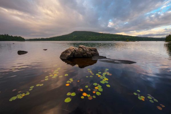
Lily pads and morning clouds over Wadleigh Pond
Maine’s Ecological Reserves, as their name implies, were created to protect a representative sample of Maine’s natural habitats with minimal interference from human activity, particularly timber harvesting. Some, like Nahmakanta, protect swathes of northern forest and wilderness ponds, while others, like Great Heath and Number Five Bog preserve pristine wetland and bog habitats. Still others, like the Bigelow Preserve and Big Spencer Mountain, encompass mountain ranges with a wide range of elevation-based plant communities, including gnarled and twisted subalpine fir and birch. Many of the Reserves don’t have rare plants or animals, but instead are meant to be refuges for species that require vulnerable habitats like old forests or alpine meadows.
As of 2018, the Ecological Reserve System is made up of 50 locations with a total area of approximately 175,000 acres. The State of Maine owns 27 of these, and the other 23 are owned by The Nature Conservancy. A number of other organizations and landowners, such as the National Park Service, Baxter State Park, and local land trusts, manage their lands with similar goals as the Ecological Reserves, bringing the total of protected land in the state up to nearly half a million acres. A new law approved in 2022 will further expand the system to protect a greater diversity of habitat across Maine.
Besides protecting native ecosystems, the Reserves also provide scientists with sites for ongoing research and monitoring, which can be used as benchmarks to judge how Maine’s managed and logged forests differ from natural forests. This research has become especially relevant as our natural environment is impacted by climate change. Despite being open to the public for low-impact uses like hiking, hunting, and fishing, outdoor recreation is secondary to the primary purposes of protection and research.
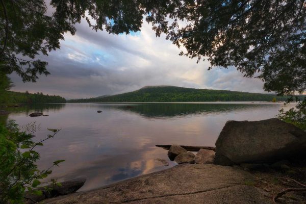
Morning clouds over Wadleigh Mountain
I awake in the morning to the sounds of a passing rain shower. Once the drops slow, I climb out of my tent and make my way down to the pond where I’m greeted with an amazing view of fog clearing from the slopes of Wadleigh Mountain. The loons responsible for the previous night’s soundtrack slowly drift by, glancing over at me in between dives. After watching the clouds drifting over the mountain for a while, I return to my campsite for a quick breakfast before heading out on the day’s adventures. As I drive toward the trailhead, a juvenile Red-tailed Hawk flies up and perches on a branch near the side of the road, its head swiveling this way and that as it looks for prey on the forest floor. I’m able to get a few pictures before it flies off, disappearing into the foliage.
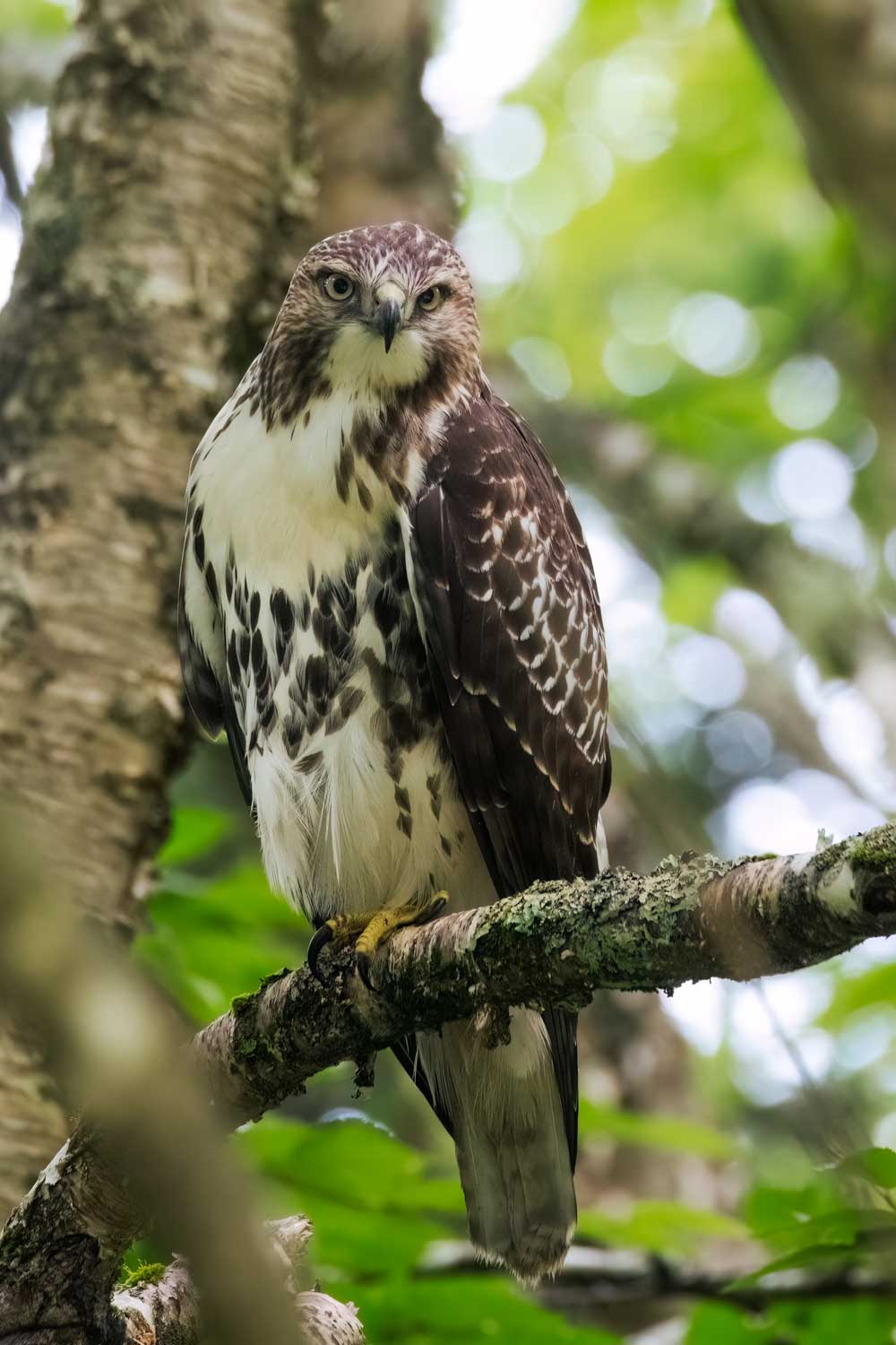
Juvenile Red-tailed Hawk hunting from a branch
The first thing that strikes me as I begin to hike is how familiar the forest feels. The moss-covered forest floor and canopy of spruce trees is something I’ve encountered all across Maine, from Acadia National Park and Downeast Maine all the way up to Baxter State Park and the Big Reed Forest Reserve. The trail, which is part of the newly completed 30-mile Great Circle Trail, winds between mossy boulders and makes its way along the shore of Pollywog Pond, although none of its namesake tadpoles are visible as I gaze into the water. Spruce-fir forests, like the one I’ve been hiking through, are one of the more common forest types in Maine. Unfortunately, few forests were spared from the axes and chainsaws of loggers, and even here most of the forests show signs of past harvesting.
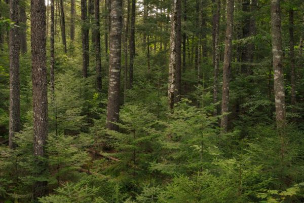
Regenerating spruce and Balsam fir
As I continue my hike, I begin to notice the incredible number of mushrooms emerging from the forest floor. Thanks to a very cloudy and rainy summer, mushrooms of all shapes, sizes, and colors can be found growing from leaf litter to spread their spores. Nearly every color of the rainbow is represented, and I spot bright Orange Mycenae, Yellow and Violet Coral mushrooms, vibrant red Vermillion Waxcaps, and even a cluster of Green-headed Jelly Clubs.
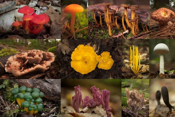
Medley of colorful mushrooms
The forests are lush with plants as well. Blue-bead Lily grow along the trail, their dark green leaves and long stalks terminating in dark blue berries breaking up the carpet of moss. A few lingering blueberries cling to the low-growing bushes. Here and there, a few Wintergreen flowers dot the forest floor, while the fruits of the Trillium flower add a splash of red to the sea of green. The slightly creepy White Baneberry, with its toxic white eyeball-like berries, stands tall over the surrounding ferns.
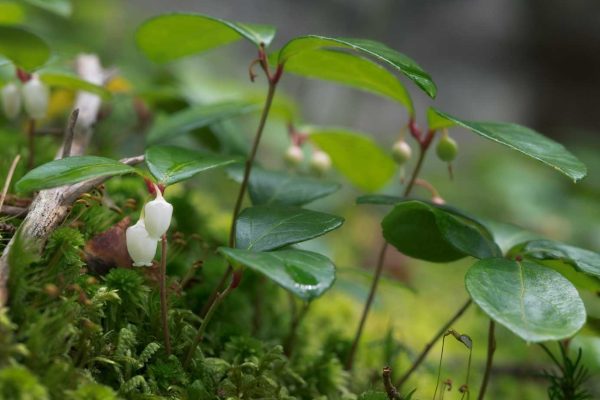
Wintergreen flowers
In contrast to the cacophony of bird song during the peak of breeding season, the woods now are largely silent as most of the birds prepare to move south. Year-round residents like Blue Jays or flocks of Golden-crowned Kinglets and Red-breasted Nuthatches can be heard moving through the trees, but the musical calls of the warblers and other seasonal visitors are nowhere to be heard. One animal that isn’t silent—the red squirrels, whose defensive chatters ring out as I pass too close to their territories.
A side trail branches off the Great Circle Trail and leads over to a pair of waterfalls, unoriginally named Upper and Lower Falls. Upper Falls is only a matter of feet away from the pond itself, while Lower Falls is a short hike farther downstream. At Lower Falls, I find a number of green frogs lurking among the rocks at the edge of the pool below the falls, as well as a White Turtlehead flower. Some plants near the water have what appears to be bird droppings on the leaves until I look closer and see that the droppings are in fact Black-and-White Sawfly larvae, curled into little spirals to avoid detection. Amazed at the ingenuity of the sawflies, I head back to the Great Circle Trail, which I follow north as it joins the Appalachian Trail. I soon reach the Pollywog Gorge, where a lookout on an outcropping of rock gives me a great view of the steep walls of the gorge and the stream below. The opposite hillside has a number of towering spruce and pine trees, the Old Man’s Beard lichens hanging from the branches, giving the appearance of great age.
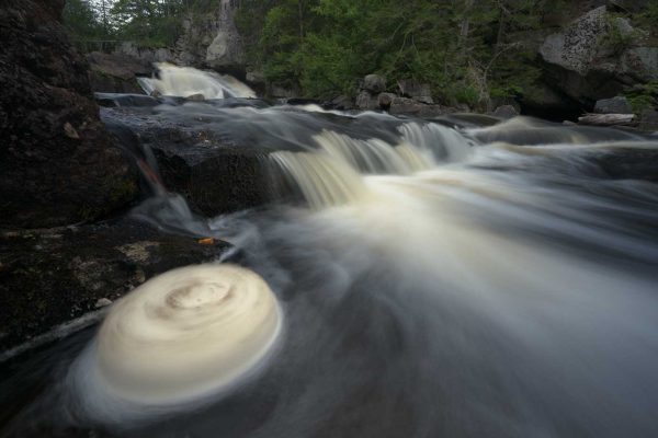
A spinning cake of foam at Lower Falls
After spending most of the day exploring the waterfalls and laying on the forest floor photographing mushrooms, I decide to hike south on the Appalachian Trail to a viewpoint that overlooks Nahmakanta Lake and almost the entire Ecological Reserve. I pass a few thru-hikers, only a few days away from finishing their 2,190-mile journey from Georgia to Katahdin. A gap in the trees reveals the lower slopes of the mountain, a cluster of clouds wrapped around the summit, standing out white against an otherwise nearly cloudless sky. A short climb later, I reach the overlook. Nahmakanta Lake fills the foreground, and golden light from the setting sun illuminates the thick forests of the Ecological Reserve on the far side of the lake.
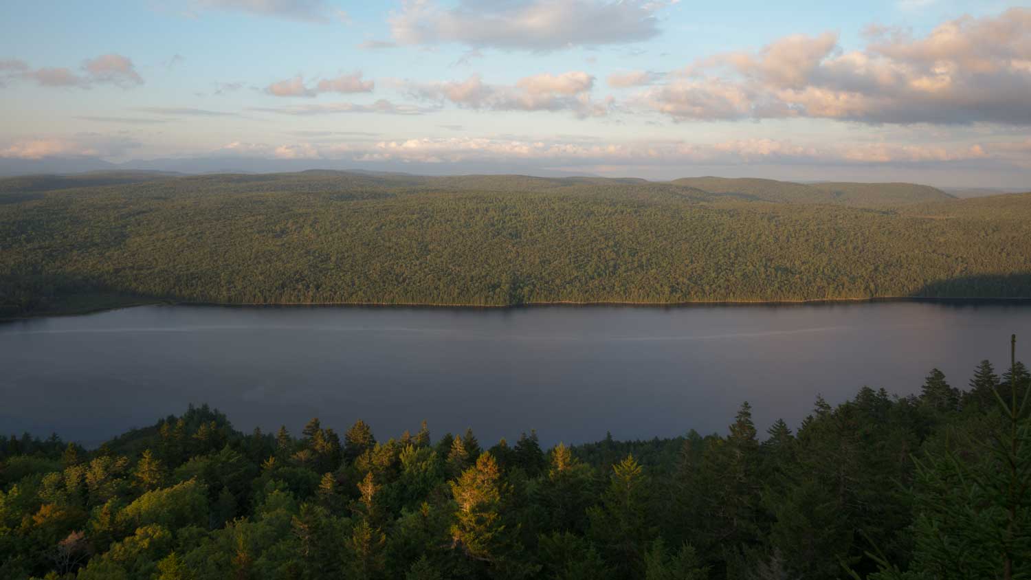
Nahmakanta Lake and Ecological Reserve as viewed from Nesuntabunt Mountain on the Appalachian Trail
As the shadows stretch longer and longer over the forests, a pair of Dark-eyed Juncos hop through the branches nearby, occasionally calling out to each other as they forage for food. One has a pure white tail and a patch of white on its face, reminiscent of a Black-capped Chickadee. Finally, the sun drops below the horizon, and I turn on my headlamp for the hike back to my car. As I hike down the trail with my headlamp illuminating the path, I’m amazed by the number of American toads hopping across the trail. I carefully step past each one, leaving them to their nocturnal hunts for food.
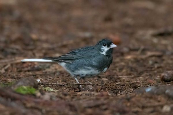
Dark-eyed Junco with a white face patch
Back at my camp, the loons continue their nighttime serenade as I eat dinner by the shore of the pond. Though I can’t see it in the moonlight, I hear a moose wading noisily along the shore nearby. Well fed, I return to my tent to get a good night’s rest in preparation for another day of exploring.
The next morning, I am woken up by loud thumps as something drops out of the trees and hits the ground around my tent. A direct hit to my rainfly brings me fully awake, and I realize the culprit is a red squirrel harvesting cones from the top of the spruce tree next to my tent. Taking that as my cue to get up, I leave the tent to get ready for another day in the forest. The forecast is calling for rain in the morning and late afternoon, so I make sure my rain gear is ready to go before heading to my next destination.
The day begins with another short hike along the Appalachian Trail to explore Rainbow Stream. The trail weaves between huge White Pines and Eastern Hemlocks, and the thick undergrowth of young Balsam Fir and Eastern White Cedar trees fills the forest to either side of the trail. Soon I come to a series of photogenic cascades that plunge through a small chasm of rock, and I spend some time exploring the area and watching the water flowing downstream. Soon the rain begins to fall, adding the patter of raindrops on leaves to the sound of water rushing over the rocks.
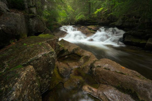
Waterfall along the Appalachian Trail
The rain continues to get heavier and heavier, so I retrace my steps and return to my campsite to shelter from the downpour. After a leisurely lunch, the sky begins to clear so I head back out for an afternoon hike following the Great Circle Trail to the shore of Nahmakanta Lake. Almost as if it was waiting for me, the sky begins to darken soon after I set foot on the trail, and by the time I reach the first overlook, the view is partially obscured behind a sheet of oncoming rain. Soon the skies open up, but I’m able to find shelter beneath an overhanging ledge of rock that blocks most of the rain.
Fortunately, it proves to be a short-lived (though heavy) rainstorm, and I’m soon back on my way. The smells of the forest are amplified by the moisture, the fresh smell of the rain competing with the musky smell of fungus and decomposition. The trail continues to wind its way around and between towering boulders, no doubt deposited by glaciers during the last Ice Age. The forest in this area is dominated more by hardwoods like birches and maples, in contrast to the spruce and fir forests of the morning. A few rays of afternoon sunlight begin to break through the departing clouds, backlighting the leaves and the drops of water still falling from them.
The trail crosses Gould Brook and meets up with the Debsconeag Backcountry Trail, which, in combination with the Great Circle Trail, forms a roughly figure-8-shaped loop through the heart of the Reserve. The left fork climbs uphill and visits a number of pristine wilderness lakes and ponds, where isolated stands of trees that are more than 300 years of age can be found. Wishing I had the time to explore the wilderness to the left, I turn right, downhill toward Nahmakanta Lake. As the trail approaches the lake, giant hemlock trees dominate my view. In other parts of the eastern U.S., the invasive hemlock woolly adelgid, a tiny aphid-like insect whose egg cases have a fuzzy cotton-like appearance, has decimated hemlock populations. It’s just starting to make its way into Maine and is currently found mostly along the coast where the winter temperatures are slightly milder. I hope that these impressive trees will be spared, but with warming winters and few effective means of controlling the woolly adelgids, I can’t help but think it’s only a matter of time before these trees too come under attack.
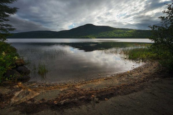
Nesuntabunt Mountain from Nahmakanta Lake
In between hemlock trunks, I see a small trail leading to the shore of the lake. I follow it, and find myself on a tiny crescent-shaped sandy beach with an amazing view of Nesuntabunt Mountain, where I can see the overlook I had been on the night before. The sky is filled with moody clouds from the retreating rainstorm, and a small opening has allowed a shaft of sunlight to illuminate some of the landscape in front of me. As I watch the clouds pass by overhead and the sun sink toward the horizon, I reflect on the role of reserves like Nahmakanta in protecting ecosystems all across the state.
Even though Nahmakanta, at its surface, seems just like forests scattered throughout the rest of Maine, monitoring surveys have shown that the Ecological Reserves are already noticeably different from forests managed for timber, despite many of them having been harvested in the past.
The Ecological Reserve forests have more volume of wood per acre, more large trees per acre, more large standing dead trees per acre, and more volume of coarse woody debris, all of which provide vital habitat for a wide range of organisms. Although it will be decades or even centuries before the forests of Nahmakanta will exhibit true old-growth forest characteristics like those of Big Reed Forest to the north, they are well on their way to helping us understand the forest structure of unmanaged forests. This knowledge can give forest managers insights into how to make working forests healthier and more complex, which in turn makes them more valuable from an ecological perspective.
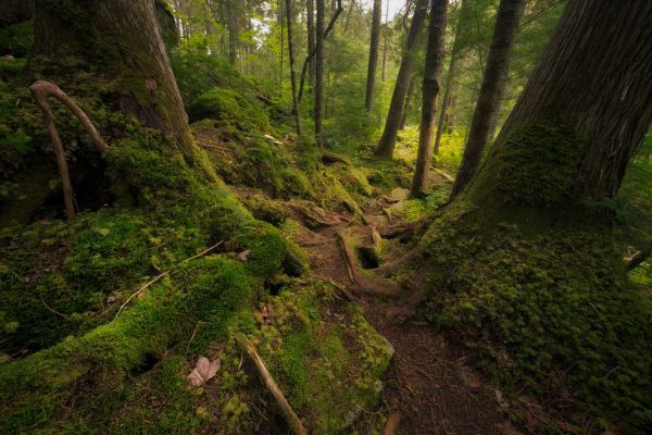
Moss-covered Eastern White Cedar trunks
Whenever I’m in the woods, I can’t help but imagine that I’m in a wild, untouched forest, free from human influence. While that is almost always not the case, the forests of Nahmakanta are perhaps closer to a natural Maine forest than almost any other place I’ve been. I think of the other Ecological Reserves and the special ecosystems they protect.
Number Five Bog, near Jackman, is recognized as one of the most remarkable bogs in the Northeast and was designated a National Natural Landmark as a result.
Mount Abraham supports some of the largest alpine habitats outside of Katahdin and provides habitat for six rare plant species.
The Deboullie Reserve encompasses a number of ponds with the rare Blueback Trout, which can only be found in 12 ponds in the entire Lower 48, all of which are in Maine.
Each of these Reserves protects important parts of Maine’s natural history, and I feel very fortunate to have been able to visit one of them. I will surely be visiting more in the future to see each of these ecosystems firsthand.
—by Nathaniel Child
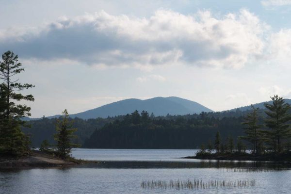
The view on Pollywog Pond
All photos by Nathaniel Child


Thank you, Nathaniel, for a beautifully written piece. You have given me the perfect way to observe Indigenous Peoples Day by honoring the land and our relationship to it.