Maine’s public lands have been good for us, providing safe places to explore and find solace. The pandemic was a reminder of just how important Land for Maine’s Future (LMF) and other public areas are for us. Getting out and enjoying these special places is a great way to demonstrate support for them. So is letting your legislators know that you support funding for LMF and our State Parks—and voting for funding when opportunities arise at the ballot box. To help you explore more of Maine, a few staff, board, and NRCM members share their public land favorites here. May these, and all of Maine’s public lands, inspire you to do what you can to ensure support for special places.—Lisa Pohlmann, CEO
Grafton Notch State Park
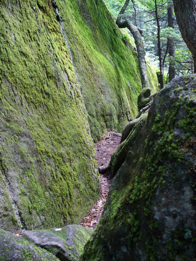
Moose Cave, Grafton Notch State Park, by Linda Woods
As often as possible, I head to Grafton Notch State Park, my favorite place on Earth. Just driving through the park fills me with awe at Creation’s magnitude. Old Speck Mountain (4,170 feet) rises majestically from one side of Route 26; Baldpate (3,789 feet) stares down from the other. Grafton Notch State Park is comprised of multiple turn-in spots, each designed to showcase the natural beauty of the area. As an outdoor person, I am drawn to the multitude of hiking opportunities available in Grafton Notch. The Moose Cave Trail provides a close-up look at a gorge with the added bonus of hearing the sound of water echoing through the rock slabs. Climbing Baldpate is an annual trek for my July birthday. In addition to being a rewarding hike with outstanding views, there is a bog between the peaks, with sundews, a carnivorous plant that lures, captures, and digests insects. Just beyond the west peak, I pick blueberries (and always leave some for the bears). Cooling off afterwards in Screw Auger Falls is a must. In spring, painted trillium abound. In the fall, I climb Table Rock (869 feet) to revel in Nature’s colorful display through the Mahoosucs and beyond to the White Mountains. Since winter is my favorite season, I enjoy cross-country skiing or snowshoeing on the many snowmobile trails throughout the Notch. Seeing the ice cave created by Mother Walker Falls is a bonus. Regardless of when I go to Grafton Notch State Park or what I do when I am there, I find my body happily tired and my spirit renewed after each visit. — Linda Woods, NRCM member, Waterville
Peaks-Kenny State Park
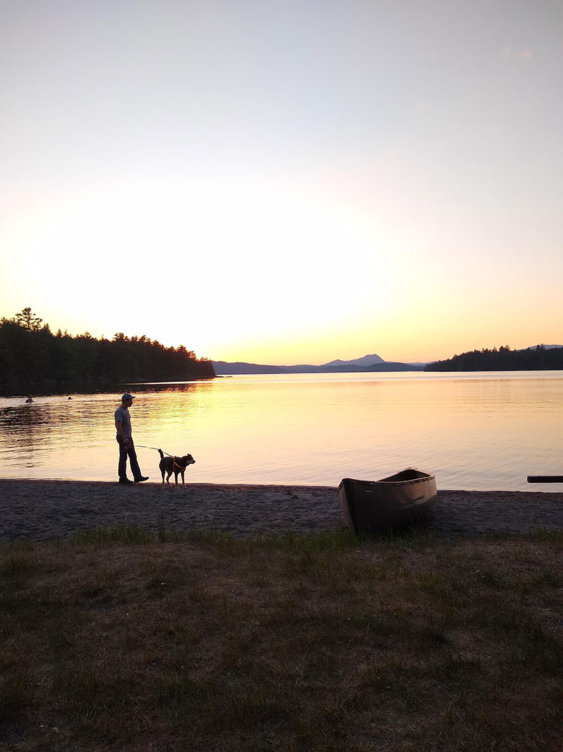
Peaks-Kenny State Park by Codi Riley-Havu
Over the past year, we have spent our time exploring new places throughout the state. A new park we discovered in June was Peaks-Kenny State Park. Nestled on the shoreline of Sebec Lake in Dover-Foxcroft, about two hours from Augusta, it was perfect for a weekend camping trip. The park offers lots of hiking, swimming, and water sport opportunities. The Birch Mountain Ledge Trail is an easy hike, and along the trail you can find twelve picnic table sculptures. A more challenging, less-traveled option is the Brown’s Point Trail. Not frequented often, the trail is overgrown and feels rugged and isolating, even though you are not far from the main park, and the end of the trail offers gorgeous views of the lake. We visited during a hot weekend, so after every hike, we headed to the pet-friendly swimming area so everyone could take a refreshing dip, including our dog. The park offers both camping and day use facilities, and it is busy during the high summer days. But, when the day use facilities close, the beach gets quiet, and you can look out over Sebec as the sunset highlights Borestone Mountain across the way. Though we spent less than 48 hours
in the park, we left feeling exhausted, happy, and looking forward to returning in the future. — Codi Riley-Havu, Records & Gifts Coordinator
Presumpscot Regional Land Trust Preserves
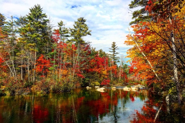
Presumpscot River Preserve by Mary Zambello
Living in Windham, I am lucky to be surrounded by a network of waterways and trails. As an avid fly fisher, and someone who often uses a walk in the woods or a connection to water to reset and refresh, I’ve grown to love the Presumpscot Regional Land Trust. With 16 public access preserves and 1,840 acres of conserved lands, with miles of public access trails and water access, there is a trail suitable for everyone. From kayaking the slow-moving currents of the Presumpscot River near Babb’s Bridge to putting in at one of three boat launches on Dundee Pond, the water trails offer you beautiful views of surrounding forests as well as opportunities for a quick dip. Trail options are endless, most ranging from easy to moderate, through various habitats, including natural forests, wetlands, alongside rivers and streams, and sweeping farmlands. You may pass by a fellow walker or biker, but almost always, you feel like you have the whole woods to yourself to enjoy the quiet and take in the surrounding wildlife. Depending on the season, you can find me hopping to various spots along the river. Whether it be fishing Gambo Dam or the Presumpscot River near Rt. 35, or kayaking up Dundee Pond, I’m fortunate for this literal and figurative breath of fresh air, year round. —NRCM member Mary Zambello, Windham
Quoddy Head State Park
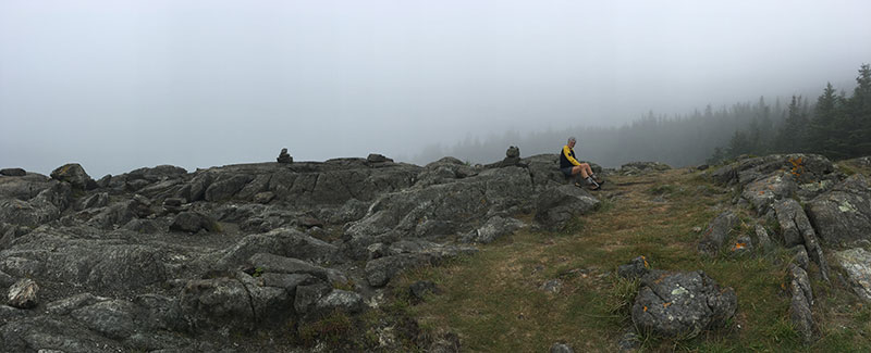
Quoddy Head State Park. Photo courtesy of Lisa Pohlmann
Once every summer, I drive Route 1 to Washington County and check out familiar places, like Wild Blueberry Land in Columbia Falls, Quoddy Bay Lobster dining in Eastport, the seals in Lubec Harbor, and Quoddy Head State Park. The cliff walk at Quoddy is a favorite. This State Park provides the easternmost point of land in the continental U.S., which is the reason we call it the Sunrise County. One sees the sun rise first there. The name Quoddy Head, which means “fertile and beautiful place,” comes from the Native American Passamaquoddy tribe. Grand Manan Island, New
Brunswick, can be seen off the coast and so can an occasional whale. After hiking a mile down the Coastal Trail, my cell phone flips to an hour later because I’ve changed time zones. Then it flips back on my return hike. At Green Point along the trail, the Bog Trail provides a boardwalk and kiosks describe this natural wonder. Lunch at one of the picnic tables overlooking the water ends a perfect day. —Lisa Pohlmann, CEO
Crooked Farm Preserve, Bristol
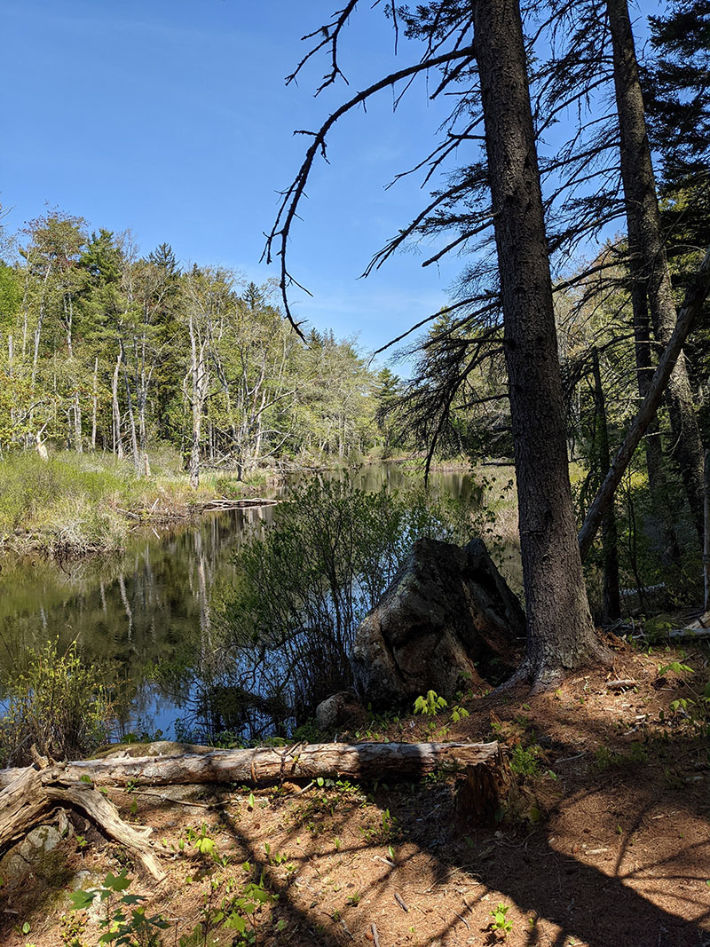
Crooked Farm Preserve by Annie Winchester
This delightfully diverse preserve is yet another gem on the Pemaquid Peninsula, and is one of the Land for Maine’s Future (LMF) program’s lasting gifts to us. Located in the Pemaquid Falls region of Bristol and managed by the Coastal Rivers Conservation Trust, its main trail first wanders through a field (look for blueberries in season), and then along the marshy frontage of the tranquil Pemaquid River where I’ve spotted Great Blue Heron and Osprey, but not yet a river otter (my friends assure me there is one). Volunteers have been hard at work making an impressive network of wooden walks over soggy spots on lowland sections of this trail. The well-maintained path takes me over ledgy terrain sprinkled with fern, bunchberry, lichens, mosses, and on to the shore of serene Boyd Pond, where I sit for a few minutes to enjoy the open view across the water. Then it’s back to the trail, winding through higher forest ground. Old pines tower above me, while
hundreds of eager shoulder-high balsams spread across the forest floor. Mossy stone walls remind me that, at one time, this cool and shady woods was farmland. The shy Ovenbird, Common Yellowthroat, and Red-eyed Vireo offer an impromptu chorus: teacher-teacher, witchety-witchety, and chewychewy! The sun filters gently through the trees and soon enough I’m back in the field again, relaxed and rejuvenated. Remember Crooked Farm when the sun at the beach is hot, the crowds at the lighthouse are buzzing, or you’ve just pushed away from the picnic table and you need a quiet interlude. Take a peaceful amble through sunny fields and sweet, piney woods…and look for that otter along the river’s edge. You’ll return home with serenity that only the natural world can offer. —Annie Winchester, NRCM Board Member
Nahmakanta Public Reserved Land
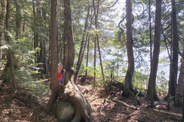
Nahmakanta Public Reserved Land. Photo courtesy of Heather Drake
In search of a day’s worth of exploring, my husband and I were directed to the Nahmakanta Public Reserved Land in Penobscot County. We headed out from our base in Greenville and traveled a couple of hours north over bumpy logging roads, on alert for possible moose sightings. The trailhead was unassuming, as was the first mile of our hike. But as we continued walking, we were graced with vibrant flora, lush forest floors, and old, drunken trees. With 12 miles of rolling hills, the trail has no real peak, but you can take in views of the surrounding area. The highlight of the trail is when you begin to hear the lapping of water and stumble upon Nahmakanta Lake. An expansive body of water, it feeds the Nahmakanta Stream, which runs along the Appalachian
Trail. What is most impressive is that amid the forest, a lake of its size can exist, in its own solitude. There is a lodge on the lake that we hope to return to for a stay and more exploring. Thanks to the Land for Maine’s Future program and National Park Service, more than 30,000 acres of Nahmakanta’s lands are protected, to remain a spot for exploring and enjoying all that Maine’s wilderness has to offer. This is definitely a spot that is worth the trip and not to be missed. —Heather Drake, NRCM Rising Member
Round Top Mountain, Rome
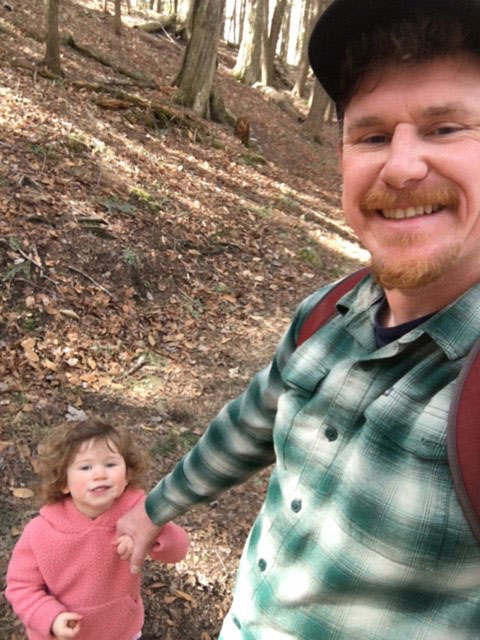
Todd and Stella hiking Round Top. Photo courtesy of Todd Martin
At 1,133 feet, Round Top Mountain is the tallest point in Kennebec County and affords spectacular views of the surrounding Belgrade Lakes. Located in Rome in the Kennebec Highlands, part of Maine’s Public Lands system, Round Top is one of my favorite hiking spots in the Kennebec Valley. This spring I took my two-year-old daughter Stella along with me. From the trail head on Watson Pond Road, the trail ascends steeply over beautiful granite slabs which, as I’ve since learned, were quarried for an old foundation. This section was a little tricky with a two-year-old, so she enjoyed this section of trail in her hiking backpack. After about a quarter mile, the trail leveled out and wound through woods. As soon as we hit level ground, Stella and I were both relieved. I got to shed 30 pounds from my back and she got to frolic along the trail as it meanders through a tranquil hardwood forest. After about a mile, the trail crossed the Kennebec Highlands Trail and continued straight. The climb was steep at this point, so Stella made her way back into the hiking backpack. After about 7/10 of a mile, we made it to the summit, which has limited views. At 3/10 of a mile, spur trails lead to a beautiful overlook, but someone was getting ready for her nap, so we turned around. Rather than complete the Round Top loop, which descends very steeply over a large rock outcropping, we descended the same way we came. I highly recommend Round Top Mountain for stunning views of the Belgrade Lakes. Stella highly recommends it, too! —Todd Martin, NRCM Rising Director and Grassroots Outreach Coordinator
Deboullie Public Reserved Land
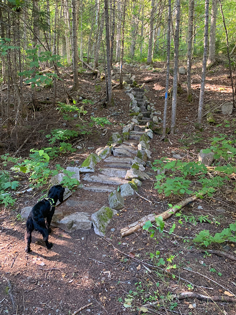
Deboullie Public Reserved Land photo by Noah Oppenheim
Like you, Melanie (NRCM Forests & Wildlife Director, and my fiancé) and I needed to get outside over Labor Day weekend last year. And like you, we also wanted to be as far away from as many of you fellow humans as possible (naturally, no offense!). So Melanie and I, along with two of our good friends, got swabbed loaded our canoes, lassoed our pandemic spaniel, and drove up to Deboullie Public Reserved Land near Fort Kent. What a spot. With several shoreside canoe portage sites nestled into glacial valleys surrounded by pristine forest, this parcel is a gem among gems. The fishery is healthy, stacks of glacial till make for excellent “cliff” jumping into the lake, and the trail system is stellar thanks to some impressive recent trail crew work. A round of Lawson’s Finest Liquids at the top of the ridge and all the cares and troubles in the world melted away for a quick moment. Just what the body and mind needed back then, and what we all will undoubtedly
benefit from again as long as our public lands remain accessible to us. Cheers to that. —Noah Oppenheim, partner to a magnificent NRCM staff member, Brunswick
Skolfield Shores
Skolfield Shores Preserve by Marlisa Simonsonl
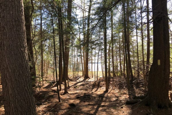
For generations, the land comprising Skolfield Shores Preserve, just off Harpswell Road, has been important wildlife habitat as well as a place significant to the people and commerce of Maine. This small preserve represents all of my favorite coastal Maine features wrapped in a tiny, neat package! Designated a Native American “carrying place,” this area was once used by the Wabanaki
because of its protected location. The ecologically rich mudflats are an important breeding ground for Atlantic horseshoe crabs and for shellfish harvesting; during my recent visit, a single clammer bent to rake mud at the low-tide line. Visiting Skolfield Shores is a sensory experience: dappled sunlight casts a path through a mixed-growth forest where I hear the call of a solitary crow. Even though the breeze is light, it is enough to create the gentle swooshing sound of white pine needles that transports me back to my childhood. The loop trail leads out to tide-soaked marsh grasses caked with salt and smelling of mud and washed-up seaweed. At their edge, I peek for a glimpse of purple clusters of sea lavender flowers and roll shards of mussel shells in my palm. I spot shelf mushrooms and two red squirrels chasing each other on my way back. Skolfield Shores Preserve is a delightful short walk in a special place, and I am grateful for the collaborative effort to forever protect it for our enjoyment. —Marlisa Simonson, Senior Director of Philanthropy
Grafton Notch State Park, Puzzle Mountain

Puzzle Mountain. Photo courtesy of Josh Caldwell
There are endless Maine lands that are deserving of praise, but I was particularly blown away this last winter by the majesty of Grafton Notch. After ensuring that trail conditions were suitable, my partner and I tossed on our snow spikes and embarked on a beautiful February ascent up Puzzle Mountain. One of dozens of peaks within Grafton Notch State Park, Puzzle Mountain has the ideal mix of elevation, 360-degree peak views, and an abundance of sightly lunch spots. Once on top, we were able to see the full sprawl of Sunday River, the stunning peak of Mount Washington, and acres and acres of Maine forest. Despite having hiked in and around Grafton Notch State Park all my life, I cannot help but be awestruck by the landscape every time I return. Each summit shows an array of worthy peaks all around, keeping my interest piqued and my hiking plans full. —Josh Caldwell, Climate & Clean Energy Outreach Coordinator
The Basin, Lake Auburn
The Basin at Lake Auburn. Photo by Henry Morjikian
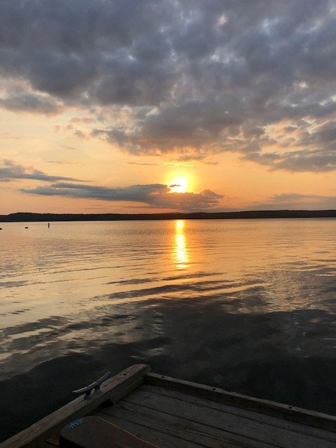
The Basin (aka Lake Auburn) is a local gem of Androscoggin County located off Rte. 4. Spanning 107 acres, this massive lake is a public water supply owned and maintained by the Lake Auburn Watershed Protection Committee. Since it is a public water supply, body contact with the water is not allowed; however, kayakers, canoers, and small motorboaters can roam the far reaches of The Basin. This is a phenomenal spot for fly and spin fishing. Largemouth bass, smallmouth bass, yellow perch, chain pickerel, lake trout, and sunfish like pumpkinseed: the list goes on. I have two go- to hang out spots at The Basin. The first is the small dock next to the public launch. I like to bring a foldable chair with a good book or guitar and greet boaters as they come in and out. The dock is especially gorgeous at dusk, with its unobstructed view of the sunset. The second is the picnic area located off Lake Shore Drive (a left off Rte. 4). The wooden benches and tables overlooking the lake are a great spot for hanging out and enjoying a meal. Talk about eating with a view! Farther down Lake Shore Drive is Taber’s Restaurant, a casual eatery with a driving range and mini golf. I have not been there myself, but friends give it high marks. The Basin is prime for reflection and tranquility, as I will often go there to destress and get some fresh air. It is beautiful during all seasons, but particularly so in the fall when the colorful foliage is in full session. —Henry Morjikian, NRCM Public Affairs & Communications Intern
Outdoor Recreation Opportunities for All
Hirundo Wildlife Refuge’s Trail of the Senses. Photo by Francesca DeSanctis
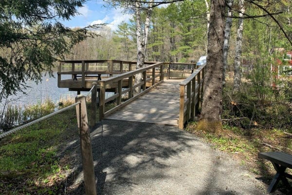
Recently, there have been articles about a new accessible trail at Hope Woods in Kennebunk and the groundbreaking for a new universally accessible trail at the Boothbay Region Land Trust’s Oak Point Farm. As someone who loves to explore Maine’s outdoors, but doesn’t feel safe climbing rocks or over roots, to hear that there are wide, flat, clear paths being created in many areas of the state excites me. The first path I heard about was mentioned in a speech by our People’s Choice Award recipient in 2016, the Hirundo Wildlife Refuge in Old Town. They created an ADA accessible “Trail of the Senses” that I wrote about in NRCM’s Nature of Maine blog. Learn more and see photos from Hirundo at www. nrcm.org/blog/maine-outdoor-recreation-opportunities-for-all. With your help, NRCM will be adding accessible trails to our Explore Maine map. If you know of universally accessible trails in Maine, please let us know (and include photos, if you have them) at nrcm@nrcm.org. —Beth Comeau, Communications Manager


