Maine’s 200th anniversary provides a unique opportunity to reflect on the special places we love. There’s the way the sun shines through a patch of forest in the hills and mountains where we hike. There is the sparkle of rivers and lakes where we swim and ply our paddles. There are many natural places dear to each of us. As we celebrate our state’s bicentennial, please ponder this question: What is that special place that inspires you to protect the nature of Maine? Here’s how some NRCM members, staff, and board responded to that question. Enjoy their answers and share your own with us! —Lisa Pohlmann, NRCM CEO
Muscongus Bay
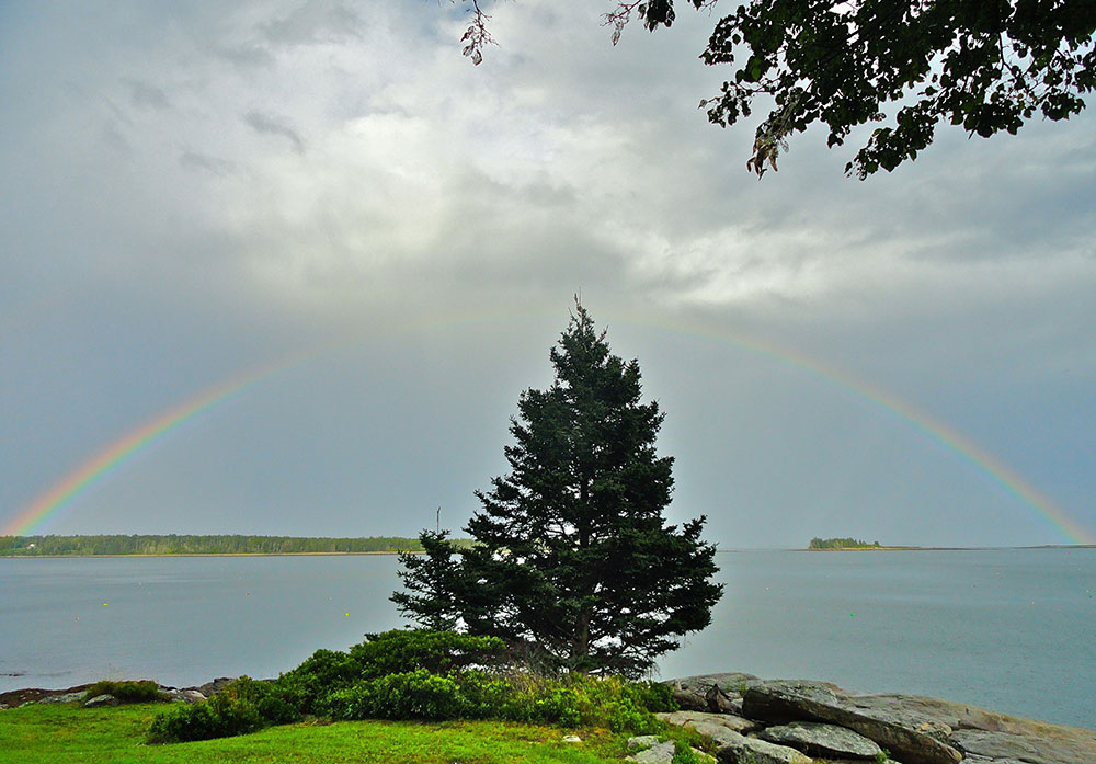
View of Loud’s and Bar Islands, Muscongus Bay, by David Preston
Often bypassed by tourists on the way to Camden or Acadia, and by sailors because of its many hazardous shoals, Muscongus Bay is a gorgeous area to explore. Bounded by Pemaquid Point to the west, Port Clyde to the east, and Monhegan Island seaward, it is home to dozens of unspoiled islands. Scattered around the perimeter and islands are numerous nature preserves such as Audubon’s Hog Island, Eastern Egg Rock (where a puffin colony can be seen in summer), and Franklin Island National Wildlife Refuge. Our family has had a summer home near Round Pond for 100 years, and we love exploring the coast by boat or kayak. Many organizations, such as the Maine Coast Heritage Trust, are working to preserve the natural beauty of this gem in the heart of Maine. —David Preston, NRCM Member, China
Boothbay Region
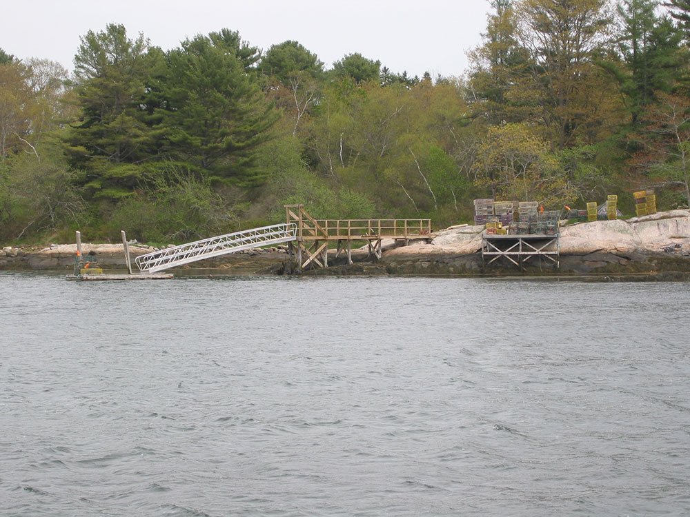
Roberts Wharf, courtesy of Boothbay Region Land Trust
It is difficult to identify a single favorite place in the Boothbay region, since there are so many that I appreciate and love. For deeply personal reasons, going back to my childhood, it would certainly be the summer cottage (a “camp”) with its three acres at the southern tip of Murray Hill. It looks out over Linekin Bay to Cabbage and Negro Islands and to Boothbay beyond. There are deciduous and conifer woods and “bear caves” explored by generations of children. It welcomes visits from friends and anyone familiar with the site. There are also the many wonderful preserves of the Boothbay Region Land Trust (BRLT), from Damariscove Island, five miles offshore and site of visits from Europeans long before the establishment of settlements, to the mainland preserves on the peninsula. The 19-acre Porter Preserve at the southern tip of Barters Island is a favorite. It can really be considered a “double” preserve, since, on the north end, it is adjacent to the Roberts Wharf working waterfront, used by kayakers and lobstermen. I go to Porter several times a year, appreciating its heavily wooded old-growth spruce, oak, and pine, and the trails that meander along nearly half a mile of shorefront on the Sheepscot and Back Rivers. There are lovely overlooks with benches for rest and enjoyment. Porter also has a lovely, south-facing beach. An old cellar hole marks the site of the old Hull home. Several years ago, BRLT dedicated a Memorial Grove on the northwestern part of the preserve. It is open to all who seek personal quiet time or wish to
commemorate loved ones. When BRLT did a survey several years ago of its most sought-out preserves, Porter was among the most appreciated, justified by the overlooks, diverse plant life, wildflowers, ferns, and shrubs, and its traces of earlier history. My wife and I frequently take visiting friends to Porter. It never fails to please. —Nathaniel Wing, NRCM Member, Boothbay Harbor
Popham Beach State Park
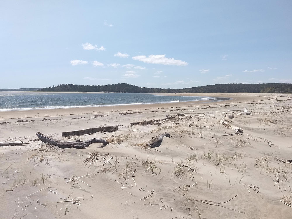
Popham Beach by Abben Maguire
Popham Beach inspires me to want to help protect the nature of Maine because Popham is a natural system evolving in real time, telling a unique story. If you visit Popham and walk as far west as you can go, you eventually meet the Morse River. The river ends in a sharp curve that cuts across the beach, contributing to the erosion of the coastline in a complex interaction between the river, sand dunes, storms, and sediment deposits. Some have suggested that this process of erosion is natural, and inevitable. Some have suggested that it is part of a cycle that repeats over a span of 50, or 25, or perhaps 15 years. Some have suggested that climate change is intensifying the extremes of these cycles. The evolution always leaves the beach looking unusual, delightful, and different. As moments in a broader story of shoreline erosion, these feelings can be bittersweet. But they are clarifying. Everyone, from beachgoer to geologist to park ranger, can walk across Popham and know that there is nature worth defending. —Abben Maguire, NRCM Accounts Payable Coordinator and Administrative Assistant
Kate Furbish Preserve: Enjoying Marsh Madness
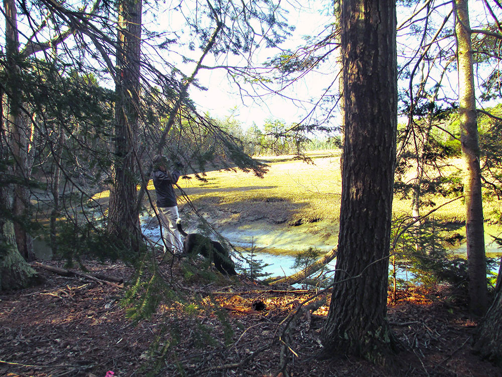
Kate Furbish East by Marcia Harrington
When the Naval Air Station in Brunswick closed in 2011, almost five square miles of land was made available for other uses. This has led to the opening of two very nice hiking and cross-country skiing trails (east and west) named after Kate Furbish, a botanist ahead of her time who helped collect and identify the native flora of Maine in the 1800s and early 1900s. While the two trails are separated by water and thus two miles apart by land, they each provide one to two hours of scenic hiking/skiing through woods and along shoreline. My favorite of the two, Kate Furbish East, was just recently opened for public use. While the trail is still a bit rough–with two-inch-high tree stumps that can catch a hiker’s toe–it is nonetheless a gem! What makes it so special is the amount of meandering shoreline overlooking a beautiful saltwater marsh tributary that weaves its way to Harpswell Sound. The trail is quiet and pristine, crossing several brooks and small ravines. Depending on the time of day, hawks, eagles, woodpeckers, and exuberant songbirds can be seen or heard. More trails are being developed to create shorter and easier options. —Marcia Harrington, NRCM Board Member, Brunswick
Ash Point Preserve, Owls Head
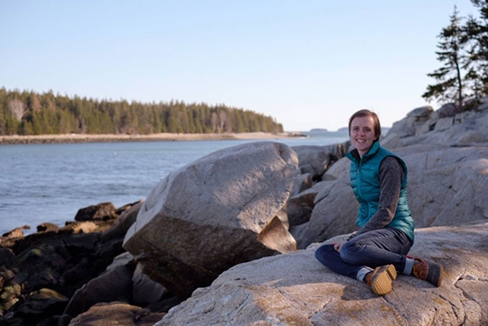
Ash Point Preserve, courtesy of Sarah Cotton
Spending time in nature, for me, is not a temporary escape from everyday life but an essential part of it. This belief continually inspires me to protect the nature of Maine. Ash Point Preserve in Owls Head is part of Georges River Land Trust, and it is just a short drive from my home. I have found it to be a very grounding place for me, a place where I can let my mind wander and not worry about what is next on my to-do list. An easy walk through the woods brings you to a beautiful rugged coast, where you can watch the rocks disappear and reappear with the tide. I usually bring a book, which is left unread as I spend my time getting lost in my thoughts. Typically, I go outdoors to be active, but when I visit Ash Point, I find myself being very still. For me, Ash Point Preserve is a place of rest, where I do not have to summit the peak to see the view. I can come, as I am, and find peace. —Sarah Cotton, NRCM Rising, Rockland
Lubec/West Quoddy Head
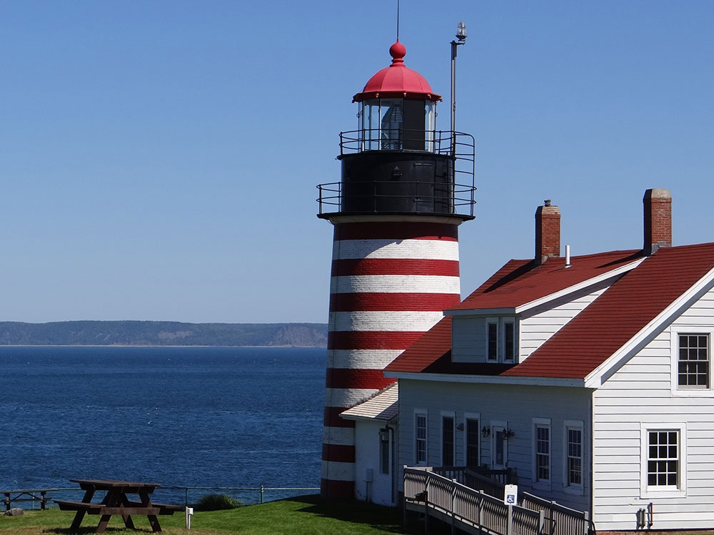
West Quoddy Head
by Beth Comeau
West Quoddy Head inspires me to help protect the nature of Maine. I haven’t been to Washington County often, but I’ve taken two trips (one in the middle of a February blizzard) to the lighthouse, near Lubec. West Quoddy Head is known for being the easternmost point in the US. I love that! It is one of the first places to see the sunrise. That inspires me. A sunrise is the start of a new day. No matter what’s happening, the sun will always rise, and we have a chance to make the most of that new day. Protecting Maine’s clean water, clean air, and wildlife is something that we can all do, in so many ways. Lubec, the town closest to West Quoddy Head, was one of the first towns to address plastic pollution and shared their plans with us in a blog post: www.nrcm.org/blog/spotlight-on-sustainability-in-maine/great-sustainability-effort-dawns-maine-town-sun-touches-first. The town’s dedication to protecting this beautiful corner of Maine from plastic pollution inspires me. If you haven’t visited Washington County, I encourage you to get up early and head to West Quoddy Head to watch the sunrise, though maybe not in a blizzard in February. —Beth Comeau, NRCM Communications Manager
South Branch Pond, Baxter State Park
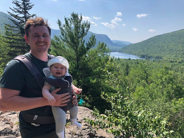
Todd and Stella at South Branch Pond
Each July, my family heads north to Baxter State Park for our annual family camping trip. While there are many special places in Baxter we have enjoyed over the years, nothing compares to the solace and beauty of South Branch Pond and the surrounding mountains and streams. From canoeing on the pond to swimming in Howe Brook to hiking up the Travelers for a stunning view, South Branch Pond truly inspires me to want to protect the nature of Maine. Plus, it’s where I proposed to my wife, which makes it extra special. Last summer was my daughter’s first trip to South Branch. She was eight months old at the time. My wife and I were a bit nervous about how she would handle the heat, bugs, and sleeping outdoors for the first time. From the moment we stepped out of our car, she was in her element. The forest floor became her playground. Our campfire enthralled her. She slept better than she did most nights in her own crib. We knew she had found the joy that we have experienced over the years in this special place. We’ve already made our camping reservations for this July and can’t wait to get back to the cool, calm waters of South Branch Pond. —Todd Martin, NRCM Rising Director and Grassroots Outreach Coordinator
Screw Auger Falls & Moose Cave, Grafton Notch
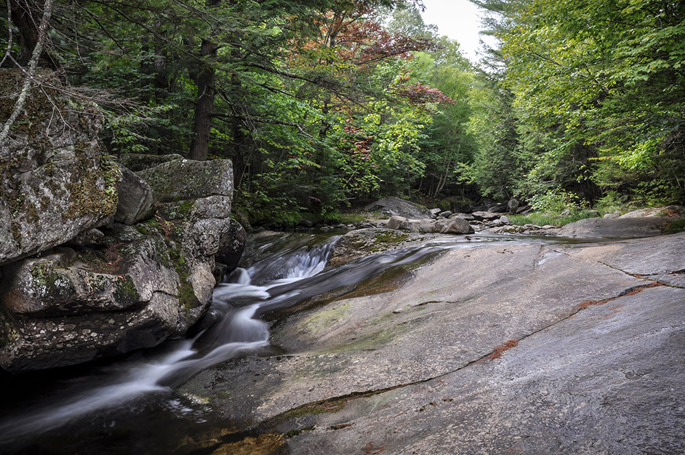
Screw Auger Falls by Ted Anderson
Grafton Notch is a spectacular glacial valley located in western Maine, just north of Newry. Route 26 wends its way through the notch in a northwesterly direction, offering views of high cliffs and narrow stream gorges. One of my two favorite locations in the notch is Screw Auger Falls. It’s where the Bear River has worn the granite smooth, creating deep potholes and a natural bridge. Depending on the season, one can feel quite energized by the sight and sound of water rushing over bedrock. About a mile northwest of the falls is Moose Cave, a 45-foot-deep bedrock canyon. Over thousands of years, slabs of rock have fallen into the canyon, forming the “cave,” sometimes obscuring the Bear River flowing beneath them. While walking the Moose Cave loop trail there are mossy ledges, natural gardens of “reindeer lichen,” and dark, slow moving pools of water to be experienced. It’s an area of quiet beauty, a place for contemplation. —Ted Anderson, NRCM Member, Westbrook
Potts Point Preserve
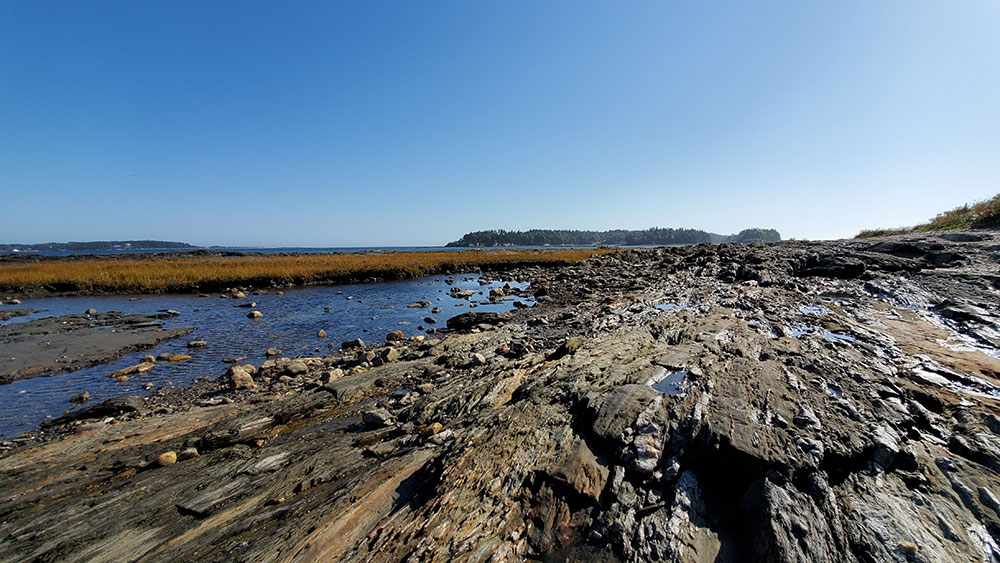
Potts Point Preserve by Levi Hahn
At the very end of South Harpswell on a parallel peninsula that lies just west of Bailey Island, Potts Point is a narrow strip of land that cuts into Casco Bay as though a jetty formed naturally for the specific purpose of allowing land creatures to enjoy the beautiful, almost 360° panorama. Managed by Harpswell Heritage Land Trust, the preserve’s rocky tip offers stunning views of nearby peninsulas and islands, and small streams empty into the sea. It’s truly a piece of paradise that just happens to be right here in Maine. Access the preserve by parking at the end of Harpswell Neck Road and walking the half-mile roundtrip dirt access road. There, a short path opens up to a quintessential Maine coastal vista: rock formations, a gravel beach full of shells, and islands and land formations that checker the sea’s surface. Tide pools abound! It’s best to visit when the tide is low because parts of the preserve may be inaccessible when the waters ascend. Preserving spaces along the coast so that they can be enjoyed by the public supports local tourism economies, but with imminent sea-level rise caused by climate change, shallow spots like Potts Point remind me of how precious and temporary our special places can be. It’s the reason we must act on both climate and land preservation. And it represents the reason we must reduce our waste to preserve the delicate aquatic life below the surface of our ocean. —Levi Hahn, NRCM Social Media & Creative Services Manager
Kennebec River
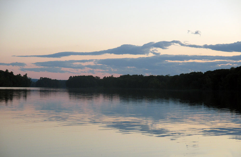
Kennebec River by Sam Horine
The Kennebec River inspires me to want to help protect nature in Maine. I love rivers, having grown up near the Ohio River. I’m particularly attached to the Kennebec because it flows by my backyard on its way from Moosehead to the ocean. Each morning I check it out—frozen or open, over its banks, how fast it’s flowing. I make a closer inspection when I go out with the dog: is the dam open? Is the river back within its banks? How about an early morning canoe upriver? What birds and animals will I see? I’m forever mindful that the river provides diverse habitat for wildlife, from loons to mayflies, moose to beaver. I’m grateful for nature’s gifts and know I must give back. I keep an eye out for shoreland zoning violations, plunk trash/debris out of the river, and share its stunning beauty through photos. —Sam Horine, NRCM Member, Skowhegan
Reid State Park
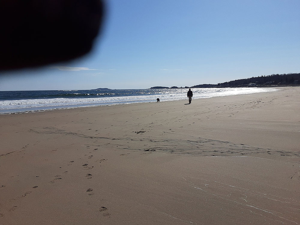
“My husband, Stephen; Labrador Retriever, Allagash, and my finger!” by Bonnie Wood
Circa March 13, the week before the “world changed,” we took a lovely four-mile walk at Reid State Park during low tide. Back then, Griffiths Head (aka One Mile) Beach had lots of other walkers who were socially distant, but once we got to Todd’s Point (aka Half Mile) Beach we pretty much had it to ourselves. We were lucky to enjoy that day because the next week, the ocean parks closed. —Bonnie Wood, NRCM Board Member, Brunswick
Little Moose Public Reserved Land
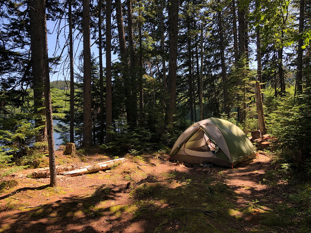
Little Moose Public Reserved Land by Stacie Haines
Maine’s Public Reserved Lands are among the best spots in the state. Last year, my kids and I chose Little Moose Public Reserved Land, located just east of Greenville, for our two-day adventure. We pitched our tent next to a remote pond complete with the sound of loons calling. As we have found at other Public Reserved Lands, there were loads of firewood and untethered (slightly leaky) boats to paddle. A loop trail afforded us beautiful views of the ponds, there were blueberries galore, and close-ups of the work accomplished by industrious beavers. If you seek a bit of adventure and the tranquility of nature, visit one of the many Public Reserved Lands that Maine has to offer. —Stacie Haines, NRCM Membership Director
Wells Reserve at Laudholm
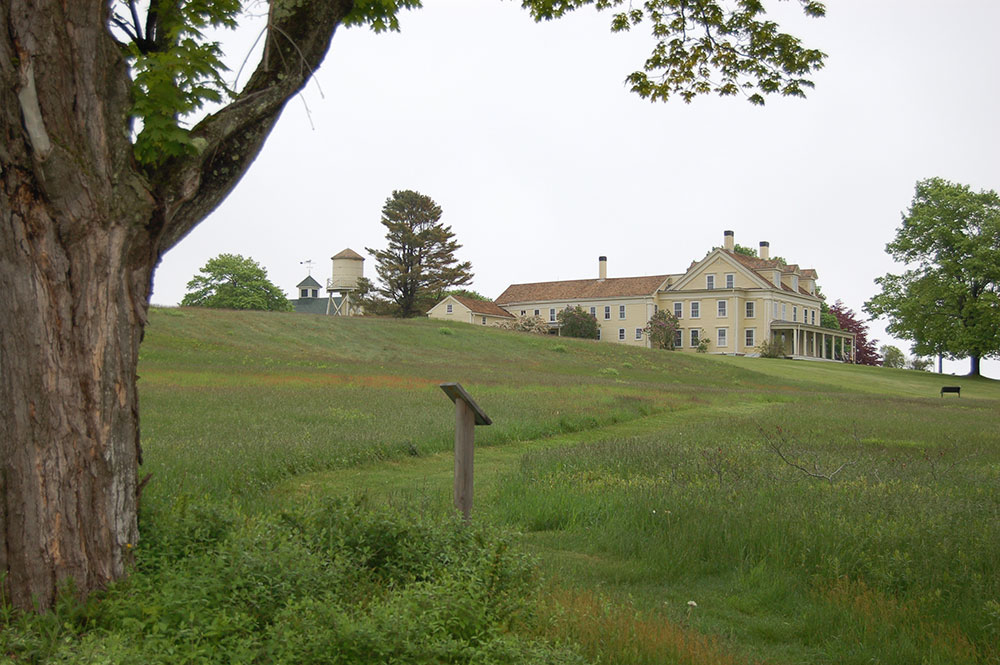
Courtesy of Wells Reserve at Laudholm
This is one of my favorite places to visit in Maine, and living nearby makes it my go-to destination for hiking, birding, watching the waves, and overall enjoyment of nature. In crowded southern
Maine, Laudholm is a rejuvenated saltwater farm, permanently protected in the 1980s by the efforts of hundreds of local people. In an area of 2,200 acres, there are more than 7 miles of trails, and what makes the Wells Reserve so special is the incredible variety of habitats they encompass. There are mixed deciduous woods, fields, pine groves, salt marsh, river’s edge, and if that isn’t enough, there’s access to a beautiful beach, too. The birding is also excellent, both in the woods and on the shore, where nesting endangered Piping Plovers are annual visitors. The Reserve is open year-round, making snowshoe and cross-country ski excursions also enticing. The Wells Reserve at Laudholm hosts many family-friendly events, like an annual Summer Craft Fair, and Punkinfiddle in the fall. The fields near the former farmhouse are filled with Bobolinks in spring and monarch butterflies in the fall. Please note that no pets or bicycles are allowed, and be sure to never disturb any nesting birds. Otherwise, enjoy a gorgeous day at beautiful Laudholm Farm. —Monica Grabin, NRCM Member, Kennebunk


