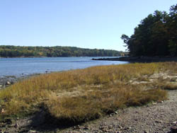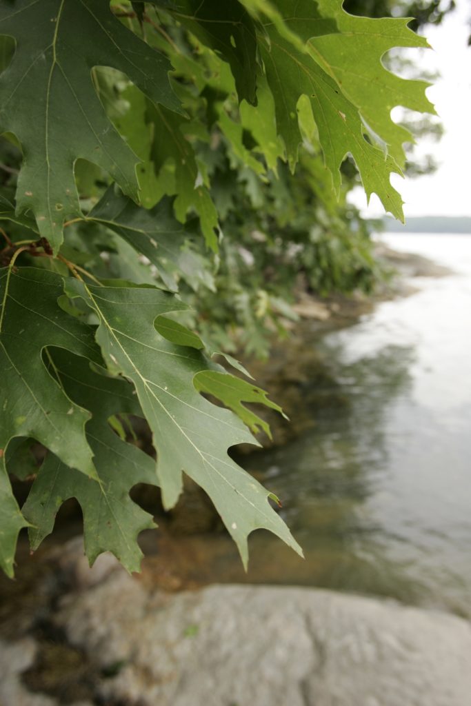
Dodge Point – photo by Allison Childs Wells
Dodge Point Public Reserved Land is a 520-acre property located on the Damariscotta River in Newcastle, just a few miles south on the River Road from downtown Damariscotta. Previously an award-winning tree farm, the property was purchased by the State in 1989, with funds from Land for Maine’s Future bonds, and the Damariscotta River Association (DRA), among other sources. Unlike other Maine Public Reserved Lands, most of which are located in remote townships, the Dodge Point property is in a well-settled area with easy access to Midcoast communities and beyond. Maine’s Public Reserved Lands are held in trust by the State for multiple uses, including public recreation.
Over the past year, Maine’s Public Reserved Lands have become the center of controversy because of Governor LePage’s proposal to increase timber harvesting with the proceeds to be diverted to uses inconsistent with the public trust for which these lands are held. Even more alarmingly, the governor has insisted that the Legislature authorize his plan, failing which he has forcefully prevented voter-approved Land for Maine’s Future bond money from being used to protect additional conservation lands throughout the state. This aggressive and unlawful action by the governor has jeopardized many previously authorized land protection projects throughout Maine.

Dodge Point – photo by Allison Childs Wells
Although I live relatively nearby, I had not visited Dodge Point since shortly after it was acquired 25 years ago. I was interested in re-acquainting myself with the property and seeing how it might have changed in the ensuing decades. I was delighted with what I saw, and came away with a renewed interest in this property because of its landscape diversity, beauty, unusually large size, extensive hiking trail network, and proximity and ease of access.
My visit deepened my concern about how Maine’s Public Reserved Lands might be abused if the governor’s efforts to harvest them more heavily come to pass. I also came away with a strengthened interest in protecting the integrity of the Land for Maine’s Future program, whose continued support is essential to the acquisition and protection of many thousands of acres of high-value lands like Dodge Point.
Armed with a trail map of the property downloaded off the DRA website, I decided to hike virtually all of the property’s five miles of trails. I did this in a loop: starting from the parking area off River Road, briefly heading down Old Farm Road Trail; then bearing left onto the Ravine Trail that winds down to the Damariscotta River; then along the river on the Shore Trail all the way to the southernmost point of the property where DRA maintains a dock; then looping back up to the Old Farm Road Trail; and finally turning onto the Timber Trail back to the entrance. I found the entire hike easy, taking about 2 ½ hours at a leisurely pace with occasional brief stops to fully enjoy the natural surroundings.
Spanning several modest hills, my hike took me through woods of varying species and age classes, along a deep ravine leading to wetlands and a pond, then along well over a mile of shorefront including several sandy beaches, past occasional large granite outcroppings and old stone walls, and pausing at the DRA dock for the expansive views up and down the river. Although I understand that timber harvesting is occasionally conducted on the property, such activities are evidently (and wisely) modest and away from the hiking trails, so I perceived no evidence of them. The entire experience was a delight.
In short, this is an unusually large shorefront property in public ownership with loads of diverse natural features and plentiful hiking opportunities. It is a treasure not to be missed in Maine’s Midcoast.
Some practical suggestions: While I took trails comprising the longest possible loop on the property, one can easily select shorter routes that include more of the Old Farm Road Trail linking to portions of the Shore Trail. There are no difficult trails here, and all are in good condition and well-signposted. While a map of the trail network is posted at the parking lot, there were no maps available to take along for the hike, so I suggest either downloading a map from the DRA website indicated above (as I did), or using a cell phone to take a picture of the map posted at the entrance for easy reference along the way. While some of the property is moderately sloping, the elevation change is less than a couple of hundred feet and should pose no difficulty for any reasonably agile hiker. There is boat access at the DRA dock at the southernmost point of the property.
In addition to its plentiful hiking opportunities, Dodge Point would be a great place to go foliage-viewing in the fall, cross-country skiing in the winter, wildflower viewing in the spring, swimming and picnicking in the summer, and bird and wildlife watching year round. Since hunting is also permitted on the property, appropriately colored clothing should be worn during deer hunting season.
by Jeff Pidot, former NRCM board member


Leave a Reply