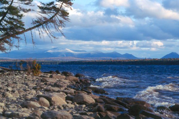
Katahdin Range from Chamberlain Lake-Fall photo by Dean Bennett
Location: In and around Township 7, Range 12 WELS, 30 miles northwest of Baxter State Park, Piscataquis County
Description: Chamberlain Lake Public Reserved Land is a group of parcels along the large lakes that form the southern end of the Allagash Wilderness Waterway. The parcels include the 2,890-acre Chamberlain Lake Ecological Reserve. Ecological Reserves serve to protect Maine’s biological diversity, among other purposes. The parcels contain mixed hardwood-conifer stands that support trees that are more than 200 years old. In addition to paddling the Waterway, visitors to the lands enjoy hiking Allagash Mountain.
Activities: Boating, camping, fishing, hunting, canoeing, and snowmobiling. Visit Maine Trail Finder to learn out how to access the Allagash Mountain Trail.
For More Information: Check out the management plan for the entirety of the Allagash Wilderness Waterway, completed in 2012.